Sântioana geodata
Sântioana (Cluj) is a populated place; located in Romania in Europe/Bucharest (GMT+3) time zone. With population of 549 people, there are 6588 cities with bigger population in this country. Compared to other cities in Romania, 78.3% of cities are located further ↓South; 69.3% of cities are located further →East and 62.3% of cities have lower elevation than Sântioana. Note1


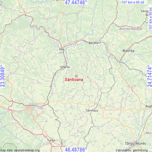
Sântioana GPS coordinates[2]
46° 58' 11.316" North, 24° 0' 41.796" East
| Map corner | latitude | longitude |
|---|---|---|
| Upper-left | 47.44746°, | 23.30849° |
| Center: | 46.96981°, | 24.01161° |
| Lower-right: | 46.48786°, | 24.71474° |
| Map W x H: | 106.7×106.7 km | = 66.3×66.3mi |
| max Lat: | 48.23793° ⇑21.7% North |
| Sântioana: | 46.96981° |
| min Lat: | ⇓78.3% South 43.65638° |
| min Long | Sântioana | max Long |
| 20.31667° | 24.01161° | 29.65403° |
| W 30.7%⇐ | ⇒69.3% E |
Elevation
Elevation of Sântioana is 276 m = 906 ft, and this is 21.1 m = 69 ft above average elevation for this country.
| Max E: |
1278 m = 4193 ft | 37.7% |
| Sântioana | 276 m 906 ft | |
| Avg. | 254.9 m = 836 ft | |
Min E: |
-2 m = -7 ft | 62.3% |
See also: Romania elevation on elevation.city.
Geographical zone
Sântioana is located in North temperate zone (between Tropic of Cancer and the Arctic Circle). Distance of this North polar circle is 2178.6 km =1353.7 mi to North.| Distance of | km | miles | from Sântioana |
|---|---|---|---|
| North Pole | 4784.5 | 2972.9 | to North |
| Arctic Circle | 2178.6 | 1353.7 | to North |
| Tropic Cancer | 2616.6 | 1625.9 | to South |
| Equator | 5222.6 | 3245.2 | to South |


Nearby cities:
15 places around Sântioana: (largest is in red/bold)
• Batin
12.1 km =7.5 mi,  18°
18°
• Buza
13.1 km =8.1 mi,  126°
126°
• Chiochiş
13.1 km =8.1 mi,  83°
83°
• Cutca
8.6 km =5.3 mi,  36°
36°
• Fizeşu Gherlii
5.6 km =3.5 mi,  337°
337°
• Geaca
13.3 km =8.3 mi,  149°
149°
• Gherla
10.1 km =6.3 mi,  314°
314°
• Livada
13.1 km =8.1 mi,  285°
285°
• Mintiu Gherlii
10.1 km =6.3 mi,  332°
332°
• Nicula
6.8 km =4.2 mi, 308°
• Năsal
8.1 km =5 mi,  110°
110°
• Pălatca
13.5 km =8.4 mi,  189°
189°
• Sic
10.5 km =6.5 mi,  247°
247°
• Sânmărtin
6.7 km =4.2 mi,  48°
48°
• Ţaga
3.7 km =2.3 mi, 127°
Sources, notices
• [Note1] Compared only with cities in Romania existing in our database
• [Src1] Map data: © OpenStreetMap contributors (CC-BY-SA)
• [Src2] Other city data from geonames.org with taken over terms of usage.
• [Src3] Geographical zone / Annual Mean Temperature by Robert A. Rohde @ Wikipedia
