Ţaga geodata
Ţaga (Cluj) is a seat of a second-order administrative division; located in Romania in Europe/Bucharest (GMT+3) time zone. With population of 2,124 people, there are 2492 cities with bigger population in this country. Compared to other cities in Romania, 77.8% of cities are located further ↓South; 68.6% of cities are located further →East and 63.2% of cities have lower elevation than Ţaga. Note1


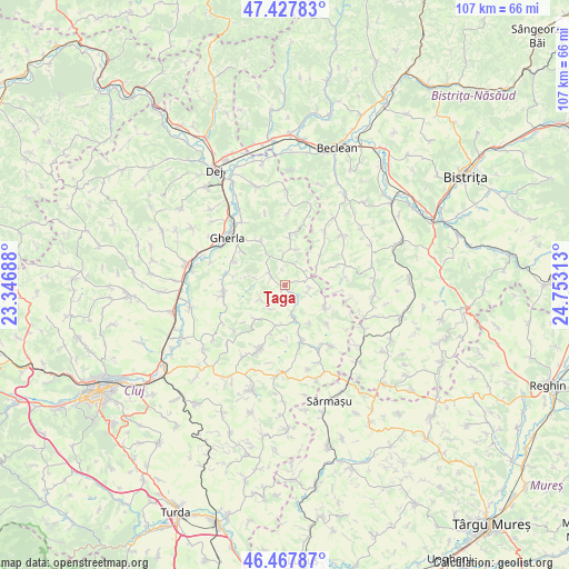
Ţaga GPS coordinates[2]
46° 57' 0" North, 24° 3' 0" East
| Map corner | latitude | longitude |
|---|---|---|
| Upper-left | 47.42783°, | 23.34688° |
| Center: | 46.95°, | 24.05° |
| Lower-right: | 46.46787°, | 24.75313° |
| Map W x H: | 106.7×106.7 km | = 66.3×66.3mi |
| max Lat: | 48.23793° ⇑22.2% North |
| Ţaga: | 46.95° |
| min Lat: | ⇓77.8% South 43.65638° |
| min Long | Ţaga | max Long |
| 20.31667° | 24.05° | 29.65403° |
| W 31.4%⇐ | ⇒68.6% E |
Elevation
Elevation of Ţaga is 280 m = 919 ft, and this is 25.1 m = 82 ft above average elevation for this country.
| Max E: |
1278 m = 4193 ft | 36.8% |
| Ţaga | 280 m 919 ft | |
| Avg. | 254.9 m = 836 ft | |
Min E: |
-2 m = -7 ft | 63.2% |
See also: Romania elevation on elevation.city.
Geographical zone
Ţaga is located in North temperate zone (between Tropic of Cancer and the Arctic Circle). Distance of this North polar circle is 2180.8 km =1355.1 mi to North.| Distance of | km | miles | from Ţaga |
|---|---|---|---|
| North Pole | 4786.7 | 2974.3 | to North |
| Arctic Circle | 2180.8 | 1355.1 | to North |
| Tropic Cancer | 2614.4 | 1624.5 | to South |
| Equator | 5220.4 | 3243.8 | to South |


Nearby cities:
15 places around Ţaga: (largest is in red/bold)
• Batin
13.7 km =8.5 mi,  3°
3°
• Buza
9.4 km =5.8 mi,  126°
126°
• Chiochiş
10.8 km =6.7 mi,  69°
69°
• Cutca
9.4 km =5.8 mi,  13°
13°
• Feldioara
10.8 km =6.7 mi, 132°
• Fizeşu Gherlii
9 km =5.6 mi,  325°
325°
• Geaca
10 km =6.2 mi,  157°
157°
• Jimbor
12.3 km =7.6 mi,  102°
102°
• Mintiu Gherlii
13.5 km =8.4 mi, 325°
• Nicula
10.4 km =6.5 mi,  308°
308°
• Năsal
4.8 km =3 mi, 97°
• Pălatca
12.2 km =7.6 mi,  204°
204°
• Sic
12.8 km =8 mi,  261°
261°
• Sânmărtin
7 km =4.3 mi,  17°
17°
• Sântioana
3.7 km =2.3 mi, 307°
Sources, notices
• [Note1] Compared only with cities in Romania existing in our database
• [Src1] Map data: © OpenStreetMap contributors (CC-BY-SA)
• [Src2] Other city data from geonames.org with taken over terms of usage.
• [Src3] Geographical zone / Annual Mean Temperature by Robert A. Rohde @ Wikipedia
