Fizeşu Gherlii geodata
Fizeşu Gherlii (Cluj) is a seat of a second-order administrative division; located in Romania in Europe/Bucharest (GMT+3) time zone. With population of 2,614 people, there are 2050 cities with bigger population in this country. Compared to other cities in Romania, 79.3% of cities are located further ↓South; 69.7% of cities are located further →East and 75.5% of cities have lower elevation than Fizeşu Gherlii. Note1


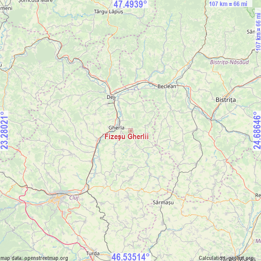
Fizeşu Gherlii GPS coordinates[2]
47° 1' 0.012" North, 23° 58' 59.988" East
| Map corner | latitude | longitude |
|---|---|---|
| Upper-left | 47.4939°, | 23.28021° |
| Center: | 47.01667°, | 23.98333° |
| Lower-right: | 46.53514°, | 24.68646° |
| Map W x H: | 106.6×106.6 km | = 66.2×66.2mi |
| max Lat: | 48.23793° ⇑20.7% North |
| Fizeşu Gherlii: | 47.01667° |
| min Lat: | ⇓79.3% South 43.65638° |
| min Long | Fizeşu Gherlii | max Long |
| 20.31667° | 23.98333° | 29.65403° |
| W 30.3%⇐ | ⇒69.7% E |
Elevation
Elevation of Fizeşu Gherlii is 357 m = 1171 ft, and this is 102.1 m = 335 ft above average elevation for this country.
| Max E: |
1278 m = 4193 ft | 24.5% |
| Fizeşu Gherlii | 357 m 1171 ft | |
| Avg. | 254.9 m = 836 ft | |
Min E: |
-2 m = -7 ft | 75.5% |
See also: Romania elevation on elevation.city.
Geographical zone
Fizeşu Gherlii is located in North temperate zone (between Tropic of Cancer and the Arctic Circle). Distance of this North polar circle is 2173.4 km =1350.5 mi to North.| Distance of | km | miles | from Fizeşu Gherlii |
|---|---|---|---|
| North Pole | 4779.3 | 2969.7 | to North |
| Arctic Circle | 2173.4 | 1350.5 | to North |
| Tropic Cancer | 2621.8 | 1629.1 | to South |
| Equator | 5227.8 | 3248.4 | to South |


Nearby cities:
15 places around Fizeşu Gherlii: (largest is in red/bold)
• Batin
8.6 km =5.3 mi,  43°
43°
• Bunești
9.1 km =5.7 mi,  300°
300°
• Cutca
7.5 km =4.7 mi,  76°
76°
• Gherla
5.4 km =3.4 mi,  290°
290°
• Livada
10.6 km =6.6 mi,  261°
261°
• Mintiu Gherlii
4.5 km =2.8 mi,  325°
325°
• Mănăstirea
11.7 km =7.3 mi,  341°
341°
• Nicula
3.3 km =2.1 mi,  252°
252°
• Nima
10.9 km =6.8 mi,  307°
307°
• Nireș
10.9 km =6.8 mi,  359°
359°
• Sic
12 km =7.5 mi,  219°
219°
• Sânmărtin
7.2 km =4.5 mi,  96°
96°
• Sântioana
5.6 km =3.5 mi,  157°
157°
• Unguraş
12.2 km =7.6 mi,  24°
24°
• Ţaga
9 km =5.6 mi,  145°
145°
Sources, notices
• [Note1] Compared only with cities in Romania existing in our database
• [Src1] Map data: © OpenStreetMap contributors (CC-BY-SA)
• [Src2] Other city data from geonames.org with taken over terms of usage.
• [Src3] Geographical zone / Annual Mean Temperature by Robert A. Rohde @ Wikipedia
