Șindrilița geodata
Șindrilița (Ilfov) is a populated place; located in Romania in Europe/Bucharest (GMT+3) time zone. With population of 925 people, there are 4536 cities with bigger population in this country. Compared to other cities in Romania, 84.9% of cities are located further ↑North; 69.3% of cities are located further ←West and 86.1% of cities have higher elevation than Șindrilița. Note1


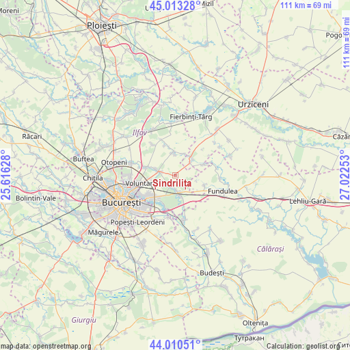
Șindrilița GPS coordinates[2]
44° 30' 50.58" North, 26° 19' 9.84" East
| Map corner | latitude | longitude |
|---|---|---|
| Upper-left | 45.01328°, | 25.61628° |
| Center: | 44.51405°, | 26.3194° |
| Lower-right: | 44.01051°, | 27.02253° |
| Map W x H: | 111.5×111.5 km | = 69.3×69.3mi |
| max Lat: | 48.23793° ⇑84.9% North |
| Șindrilița: | 44.51405° |
| min Lat: | ⇓15.1% South 43.65638° |
| min Long | Șindrilița | max Long |
| 20.31667° | 26.3194° | 29.65403° |
| W 69.3%⇐ | ⇒30.7% E |
Elevation
Elevation of Șindrilița is 75 m = 246 ft, and this is 179.9 m = 590 ft below average elevation for this country.
| Max E: |
1278 m = 4193 ft | 86.1% |
| Avg. | 254.9 m = 836 ft | |
| Șindrilița | 75 m = 246 ft | |
Min E: |
-2 m = -7 ft | 13.9% |
See also: Romania elevation on elevation.city.
Geographical zone
Șindrilița is located in North temperate zone (between Tropic of Cancer and the Arctic Circle). Distance of this Northern Tropic circle is 2343.6 km =1456.2 mi to South.| Distance of | km | miles | from Șindrilița |
|---|---|---|---|
| North Pole | 5057.6 | 3142.6 | to North |
| Arctic Circle | 2451.7 | 1523.4 | to North |
| Tropic Cancer | 2343.6 | 1456.2 | to South |
| Equator | 4949.5 | 3075.5 | to South |


Nearby cities:
15 places around Șindrilița: (largest is in red/bold)
• Afumaţi
4.2 km =2.6 mi,  273°
273°
• Belciugatele
9.7 km =6 mi,  110°
110°
• Brăneşti
7.2 km =4.5 mi,  171°
171°
• Cernica
11.2 km =7 mi,  194°
194°
• Cozieni
4.1 km =2.5 mi,  197°
197°
• Dascălu
11.7 km =7.3 mi,  324°
324°
• Găneasa
4.5 km =2.8 mi,  219°
219°
• Islaz
8 km =5 mi,  137°
137°
• Lilieci
6.1 km =3.8 mi,  49°
49°
• Moara Domnească
5.4 km =3.4 mi,  244°
244°
• Pasărea
4.6 km =2.9 mi,  179°
179°
• Petrăchioaia
7.5 km =4.7 mi,  355°
355°
• Piteasca
2.5 km =1.6 mi,  159°
159°
• Sineşti
7.7 km =4.8 mi,  40°
40°
• Ştefăneştii de Jos
9.7 km =6 mi,  282°
282°
Sources, notices
• [Note1] Compared only with cities in Romania existing in our database
• [Src1] Map data: © OpenStreetMap contributors (CC-BY-SA)
• [Src2] Other city data from geonames.org with taken over terms of usage.
• [Src3] Geographical zone / Annual Mean Temperature by Robert A. Rohde @ Wikipedia
