Islaz geodata
Islaz (Ilfov) is a populated place; located in Romania in Europe/Bucharest (GMT+3) time zone. With population of 1,265 people, there are 3603 cities with bigger population in this country. Compared to other cities in Romania, 86.3% of cities are located further ↑North; 70.6% of cities are located further ←West and 87.4% of cities have higher elevation than Islaz. Note1


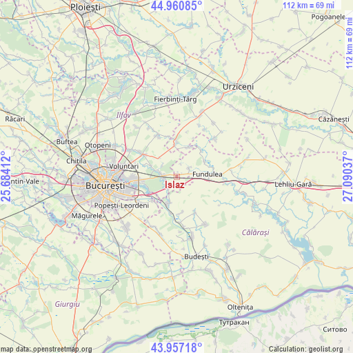
Islaz GPS coordinates[2]
44° 27' 40.212" North, 26° 23' 14.064" East
| Map corner | latitude | longitude |
|---|---|---|
| Upper-left | 44.96085°, | 25.68412° |
| Center: | 44.46117°, | 26.38724° |
| Lower-right: | 43.95718°, | 27.09037° |
| Map W x H: | 111.6×111.6 km | = 69.3×69.3mi |
| max Lat: | 48.23793° ⇑86.3% North |
| Islaz: | 44.46117° |
| min Lat: | ⇓13.7% South 43.65638° |
| min Long | Islaz | max Long |
| 20.31667° | 26.38724° | 29.65403° |
| W 70.6%⇐ | ⇒29.4% E |
Elevation
Elevation of Islaz is 70 m = 230 ft, and this is 184.9 m = 607 ft below average elevation for this country.
| Max E: |
1278 m = 4193 ft | 87.4% |
| Avg. | 254.9 m = 836 ft | |
| Islaz | 70 m = 230 ft | |
Min E: |
-2 m = -7 ft | 12.6% |
See also: Romania elevation on elevation.city.
Geographical zone
Islaz is located in North temperate zone (between Tropic of Cancer and the Arctic Circle). Distance of this Northern Tropic circle is 2337.7 km =1452.6 mi to South.| Distance of | km | miles | from Islaz |
|---|---|---|---|
| North Pole | 5063.4 | 3146.2 | to North |
| Arctic Circle | 2457.6 | 1527.1 | to North |
| Tropic Cancer | 2337.7 | 1452.6 | to South |
| Equator | 4943.6 | 3071.8 | to South |


Nearby cities:
15 places around Islaz: (largest is in red/bold)
• Belciugatele
4.4 km =2.7 mi,  56°
56°
• Brăneşti
4.5 km =2.8 mi,  253°
253°
• Bălăceanca
10.9 km =6.8 mi,  225°
225°
• Cernica
9.6 km =6 mi,  239°
239°
• Cozieni
6.9 km =4.3 mi,  286°
286°
• Fundeni
9.1 km =5.7 mi,  198°
198°
• Fundulea
10.3 km =6.4 mi,  86°
86°
• Gostilele
9.9 km =6.2 mi, 61°
• Găneasa
8.6 km =5.3 mi, 286°
• Lilieci
9.8 km =6.1 mi,  355°
355°
• Moara Domnească
10.8 km =6.7 mi, 289°
• Pasărea
5.5 km =3.4 mi,  283°
283°
• Piteasca
5.8 km =3.6 mi,  308°
308°
• Tânganu
8.5 km =5.3 mi,  224°
224°
• Șindrilița
8 km =5 mi,  317°
317°
Sources, notices
• [Note1] Compared only with cities in Romania existing in our database
• [Src1] Map data: © OpenStreetMap contributors (CC-BY-SA)
• [Src2] Other city data from geonames.org with taken over terms of usage.
• [Src3] Geographical zone / Annual Mean Temperature by Robert A. Rohde @ Wikipedia
