Seliștea geodata
Seliștea (Mehedinţi) is a populated place; located in Romania in Europe/Bucharest (GMT+3) time zone. With population of 551 people, there are 6574 cities with bigger population in this country. Compared to other cities in Romania, 70.5% of cities are located further ↑North; 88.6% of cities are located further →East and 84.6% of cities have lower elevation than Seliștea. Note1


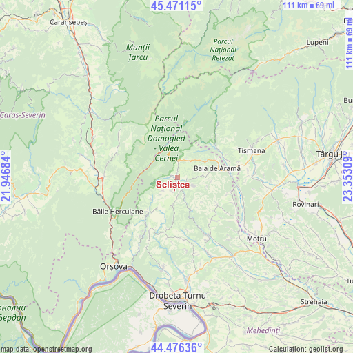
Seliștea GPS coordinates[2]
44° 58' 33.276" North, 22° 38' 59.856" East
| Map corner | latitude | longitude |
|---|---|---|
| Upper-left | 45.47115°, | 21.94684° |
| Center: | 44.97591°, | 22.64996° |
| Lower-right: | 44.47636°, | 23.35309° |
| Map W x H: | 110.6×110.6 km | = 68.7×68.7mi |
| max Lat: | 48.23793° ⇑70.5% North |
| Seliștea: | 44.97591° |
| min Lat: | ⇓29.5% South 43.65638° |
| min Long | Seliștea | max Long |
| 20.31667° | 22.64996° | 29.65403° |
| W 11.4%⇐ | ⇒88.6% E |
Elevation
Elevation of Seliștea is 442 m = 1450 ft, and this is 187.1 m = 614 ft above average elevation for this country.
| Max E: |
1278 m = 4193 ft | 15.4% |
| Seliștea | 442 m 1450 ft | |
| Avg. | 254.9 m = 836 ft | |
Min E: |
-2 m = -7 ft | 84.6% |
See also: Romania elevation on elevation.city.
Geographical zone
Seliștea is located in North temperate zone (between Tropic of Cancer and the Arctic Circle). Distance of this Northern Tropic circle is 2394.9 km =1488.1 mi to South.| Distance of | km | miles | from Seliștea |
|---|---|---|---|
| North Pole | 5006.2 | 3110.7 | to North |
| Arctic Circle | 2400.3 | 1491.5 | to North |
| Tropic Cancer | 2394.9 | 1488.1 | to South |
| Equator | 5000.9 | 3107.4 | to South |


Nearby cities:
15 places around Seliștea: (largest is in red/bold)
• Baia de Aramă
12.7 km =7.9 mi,  78°
78°
• Bala de Sus
15.5 km =9.6 mi,  123°
123°
• Balta
9.9 km =6.2 mi,  185°
185°
• Cloșani
15.8 km =9.8 mi,  49°
49°
• Călugăreni
15.8 km =9.8 mi,  58°
58°
• Isverna
1.7 km =1.1 mi,  284°
284°
• Motru Sec
14.8 km =9.2 mi, 49°
• Mărășești
11 km =6.8 mi, 62°
• Negoești
16.6 km =10.3 mi,  87°
87°
• Obârşia-Cloşani
5.2 km =3.2 mi,  30°
30°
• Padeş
16.4 km =10.2 mi,  73°
73°
• Podeni
13.5 km =8.4 mi,  218°
218°
• Ponoarele
9 km =5.6 mi, 91°
• Rudina
15.7 km =9.8 mi,  133°
133°
• Şovarna
17.6 km =10.9 mi,  140°
140°
Sources, notices
• [Note1] Compared only with cities in Romania existing in our database
• [Src1] Map data: © OpenStreetMap contributors (CC-BY-SA)
• [Src2] Other city data from geonames.org with taken over terms of usage.
• [Src3] Geographical zone / Annual Mean Temperature by Robert A. Rohde @ Wikipedia
