Săvădisla geodata
Săvădisla (Cluj) is a seat of a second-order administrative division; located in Romania in Europe/Bucharest (GMT+3) time zone. With population of 4,433 people, there are 978 cities with bigger population in this country. Compared to other cities in Romania, 71.1% of cities are located further ↓South; 77.8% of cities are located further →East and 92.1% of cities have lower elevation than Săvădisla. Note1


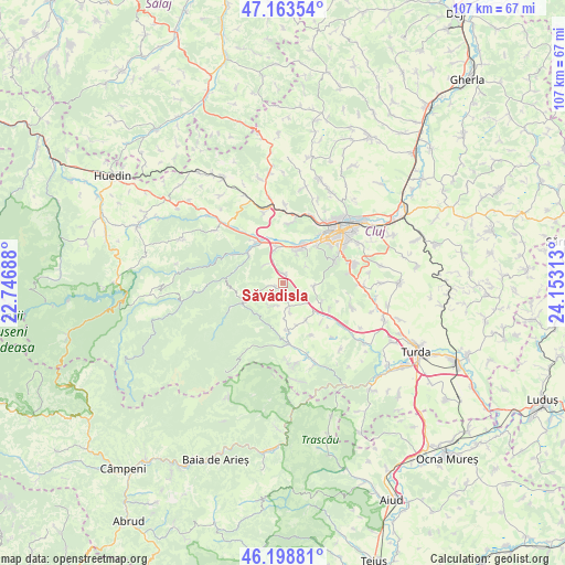
Săvădisla GPS coordinates[2]
46° 40' 59.988" North, 23° 27' 0" East
| Map corner | latitude | longitude |
|---|---|---|
| Upper-left | 47.16354°, | 22.74688° |
| Center: | 46.68333°, | 23.45° |
| Lower-right: | 46.19881°, | 24.15313° |
| Map W x H: | 107.3×107.3 km | = 66.7×66.7mi |
| max Lat: | 48.23793° ⇑28.9% North |
| Săvădisla: | 46.68333° |
| min Lat: | ⇓71.1% South 43.65638° |
| min Long | Săvădisla | max Long |
| 20.31667° | 23.45° | 29.65403° |
| W 22.2%⇐ | ⇒77.8% E |
Elevation
Elevation of Săvădisla is 551 m = 1808 ft, and this is 296.1 m = 971 ft above average elevation for this country.
| Max E: |
1278 m = 4193 ft | 7.9% |
| Săvădisla | 551 m 1808 ft | |
| Avg. | 254.9 m = 836 ft | |
Min E: |
-2 m = -7 ft | 92.1% |
See also: Romania elevation on elevation.city.
Geographical zone
Săvădisla is located in North temperate zone (between Tropic of Cancer and the Arctic Circle). Distance of this North polar circle is 2210.5 km =1373.5 mi to North.| Distance of | km | miles | from Săvădisla |
|---|---|---|---|
| North Pole | 4816.4 | 2992.8 | to North |
| Arctic Circle | 2210.5 | 1373.5 | to North |
| Tropic Cancer | 2584.8 | 1606.1 | to South |
| Equator | 5190.7 | 3225.4 | to South |


Nearby cities:
15 places around Săvădisla: (largest is in red/bold)
• Agriș
11.3 km =7 mi,  151°
151°
• Băişoara
11.2 km =7 mi,  173°
173°
• Ciurila
8.5 km =5.3 mi,  115°
115°
• Feleacu
13.2 km =8.2 mi,  73°
73°
• Finișel
1.9 km =1.2 mi,  247°
247°
• Floreşti
7.7 km =4.8 mi,  25°
25°
• Gilău
8.7 km =5.4 mi,  309°
309°
• Hășdate
4.7 km =2.9 mi,  200°
200°
• Luna de Sus
6.7 km =4.2 mi,  350°
350°
• Micești
13.6 km =8.5 mi,  109°
109°
• Muntele Rece
13.3 km =8.3 mi, 251°
• Someșu Cald
10.7 km =6.6 mi,  301°
301°
• Suceagu
11.3 km =7 mi,  5°
5°
• Valea Ierii
8.5 km =5.3 mi,  244°
244°
• Vlaha
1.5 km =0.9 mi,  15°
15°
Sources, notices
• [Note1] Compared only with cities in Romania existing in our database
• [Src1] Map data: © OpenStreetMap contributors (CC-BY-SA)
• [Src2] Other city data from geonames.org with taken over terms of usage.
• [Src3] Geographical zone / Annual Mean Temperature by Robert A. Rohde @ Wikipedia
