Românești geodata
Românești (Botoşani) is a seat of a second-order administrative division; located in Romania in Europe/Bucharest (GMT+3) time zone. With population of 1,497 people, there are 3183 cities with bigger population in this country. Compared to other cities in Romania, 95.4% of cities are located further ↓South; 87.5% of cities are located further ←West and 88.8% of cities have higher elevation than Românești. Note1


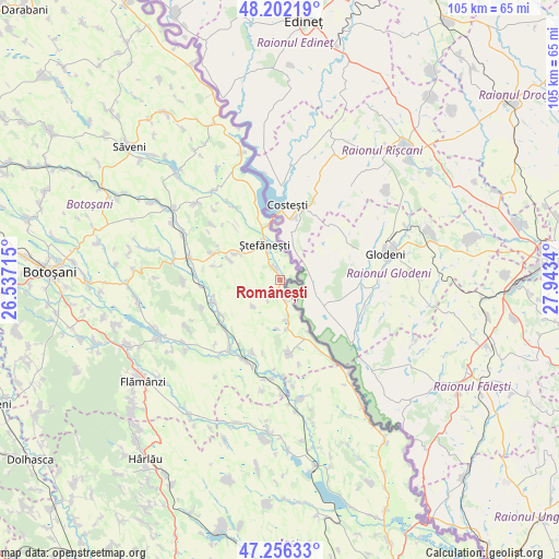
Românești GPS coordinates[2]
47° 43' 53.076" North, 27° 14' 24.972" East
| Map corner | latitude | longitude |
|---|---|---|
| Upper-left | 48.20219°, | 26.53715° |
| Center: | 47.73141°, | 27.24027° |
| Lower-right: | 47.25633°, | 27.9434° |
| Map W x H: | 105.2×105.2 km | = 65.4×65.4mi |
| max Lat: | 48.23793° ⇑4.6% North |
| Românești: | 47.73141° |
| min Lat: | ⇓95.4% South 43.65638° |
| min Long | Românești | max Long |
| 20.31667° | 27.24027° | 29.65403° |
| W 87.5%⇐ | ⇒12.5% E |
Elevation
Elevation of Românești is 64 m = 210 ft, and this is 190.9 m = 626 ft below average elevation for this country.
| Max E: |
1278 m = 4193 ft | 88.8% |
| Avg. | 254.9 m = 836 ft | |
| Românești | 64 m = 210 ft | |
Min E: |
-2 m = -7 ft | 11.2% |
See also: Romania elevation on elevation.city.
Geographical zone
Românești is located in North temperate zone (between Tropic of Cancer and the Arctic Circle). Distance of this North polar circle is 2093.9 km =1301.1 mi to North.| Distance of | km | miles | from Românești |
|---|---|---|---|
| North Pole | 4699.8 | 2920.3 | to North |
| Arctic Circle | 2093.9 | 1301.1 | to North |
| Tropic Cancer | 2701.3 | 1678.5 | to South |
| Equator | 5307.2 | 3297.7 | to South |


Nearby cities:
15 places around Românești: (largest is in red/bold)
• Albeşti
13.4 km =8.3 mi,  254°
254°
• Bobulești
2.4 km =1.5 mi,  335°
335°
• Buimăceni
13 km =8.1 mi,  239°
239°
• Băbiceni
12.6 km =7.8 mi,  281°
281°
• Bădiuți
6.3 km =3.9 mi, 337°
• Cucuteni
9.3 km =5.8 mi,  304°
304°
• Călăraşi
12.9 km =8 mi,  171°
171°
• Durneşti
11.2 km =7 mi,  290°
290°
• Dămideni
4 km =2.5 mi, 165°
• Guranda
13.8 km =8.6 mi, 291°
• Libertatea
13.2 km =8.2 mi,  164°
164°
• Stânca
10.5 km =6.5 mi,  345°
345°
• Tudor Vladimirescu
7.1 km =4.4 mi,  225°
225°
• Ştefăneşti-Sat
7.2 km =4.5 mi,  323°
323°
• Ștefănești
7.3 km =4.5 mi, 336°
Sources, notices
• [Note1] Compared only with cities in Romania existing in our database
• [Src1] Map data: © OpenStreetMap contributors (CC-BY-SA)
• [Src2] Other city data from geonames.org with taken over terms of usage.
• [Src3] Geographical zone / Annual Mean Temperature by Robert A. Rohde @ Wikipedia
