Pungeşti geodata
Pungeşti (Vaslui) is a seat of a second-order administrative division; located in Romania in Europe/Bucharest (GMT+3) time zone. With population of 3,453 people, there are 1454 cities with bigger population in this country. Compared to other cities in Romania, 71.7% of cities are located further ↓South; 88.7% of cities are located further ←West and 58% of cities have lower elevation than Pungeşti. Note1


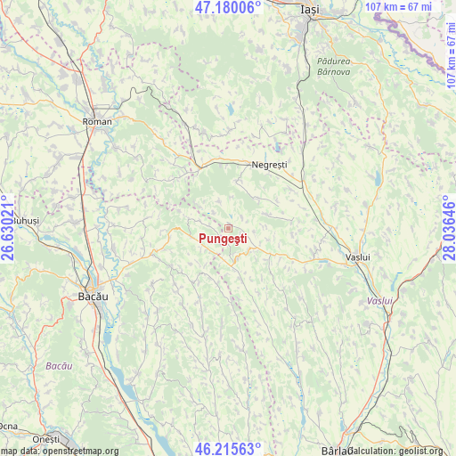
Pungeşti GPS coordinates[2]
46° 42' 0" North, 27° 19' 59.988" East
| Map corner | latitude | longitude |
|---|---|---|
| Upper-left | 47.18006°, | 26.63021° |
| Center: | 46.7°, | 27.33333° |
| Lower-right: | 46.21563°, | 28.03646° |
| Map W x H: | 107.2×107.2 km | = 66.6×66.6mi |
| max Lat: | 48.23793° ⇑28.3% North |
| Pungeşti: | 46.7° |
| min Lat: | ⇓71.7% South 43.65638° |
| min Long | Pungeşti | max Long |
| 20.31667° | 27.33333° | 29.65403° |
| W 88.7%⇐ | ⇒11.3% E |
Elevation
Elevation of Pungeşti is 253 m = 830 ft, and this is 1.9 m = 6 ft below average elevation for this country.
| Max E: |
1278 m = 4193 ft | 42% |
| Avg. | 254.9 m = 836 ft | |
| Pungeşti | 253 m = 830 ft | |
Min E: |
-2 m = -7 ft | 58% |
See also: Romania elevation on elevation.city.
Geographical zone
Pungeşti is located in North temperate zone (between Tropic of Cancer and the Arctic Circle). Distance of this North polar circle is 2208.6 km =1372.4 mi to North.| Distance of | km | miles | from Pungeşti |
|---|---|---|---|
| North Pole | 4814.5 | 2991.6 | to North |
| Arctic Circle | 2208.6 | 1372.4 | to North |
| Tropic Cancer | 2586.6 | 1607.2 | to South |
| Equator | 5192.6 | 3226.5 | to South |


Nearby cities:
15 places around Pungeşti: (largest is in red/bold)
• Armășoaia
4.1 km =2.5 mi,  108°
108°
• Buda
9.6 km =6 mi,  44°
44°
• Doagele
3.3 km =2.1 mi,  181°
181°
• Dragomireşti
7.5 km =4.7 mi,  170°
170°
• Fundu Tutovei
11.1 km =6.9 mi,  267°
267°
• Fâstâci
9.5 km =5.9 mi,  68°
68°
• Gârceni
8.3 km =5.2 mi,  332°
332°
• Ivănești
12.1 km =7.5 mi,  126°
126°
• Lipova
7.8 km =4.8 mi,  283°
283°
• Oşeşti
12.6 km =7.8 mi,  53°
53°
• Plopana
9.1 km =5.7 mi,  258°
258°
• Rafaila
11.4 km =7.1 mi,  11°
11°
• Rădeni
12.6 km =7.8 mi, 165°
• Satu Nou
2.9 km =1.8 mi,  244°
244°
• Toporăști
6 km =3.7 mi,  97°
97°
Sources, notices
• [Note1] Compared only with cities in Romania existing in our database
• [Src1] Map data: © OpenStreetMap contributors (CC-BY-SA)
• [Src2] Other city data from geonames.org with taken over terms of usage.
• [Src3] Geographical zone / Annual Mean Temperature by Robert A. Rohde @ Wikipedia
