Pucheni geodata
Pucheni (Dâmboviţa) is a seat of a second-order administrative division; located in Romania in Europe/Bucharest (GMT+3) time zone. With population of 2,201 people, there are 2423 cities with bigger population in this country. Compared to other cities in Romania, 62.5% of cities are located further ↑North; 51.1% of cities are located further ←West and 96.1% of cities have lower elevation than Pucheni. Note1


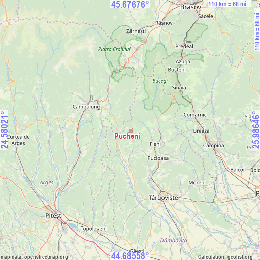
Pucheni GPS coordinates[2]
45° 10' 59.988" North, 25° 16' 59.988" East
| Map corner | latitude | longitude |
|---|---|---|
| Upper-left | 45.67676°, | 24.58021° |
| Center: | 45.18333°, | 25.28333° |
| Lower-right: | 44.68558°, | 25.98646° |
| Map W x H: | 110.2×110.2 km | = 68.5×68.5mi |
| max Lat: | 48.23793° ⇑62.5% North |
| Pucheni: | 45.18333° |
| min Lat: | ⇓37.5% South 43.65638° |
| min Long | Pucheni | max Long |
| 20.31667° | 25.28333° | 29.65403° |
| W 51.1%⇐ | ⇒48.9% E |
Elevation
Elevation of Pucheni is 671 m = 2201 ft, and this is 416.1 m = 1365 ft above average elevation for this country.
| Max E: |
1278 m = 4193 ft | 3.9% |
| Pucheni | 671 m 2201 ft | |
| Avg. | 254.9 m = 836 ft | |
Min E: |
-2 m = -7 ft | 96.1% |
See also: Romania elevation on elevation.city.
Geographical zone
Pucheni is located in North temperate zone (between Tropic of Cancer and the Arctic Circle). Distance of this North polar circle is 2377.3 km =1477.2 mi to North.| Distance of | km | miles | from Pucheni |
|---|---|---|---|
| North Pole | 4983.1 | 3096.4 | to North |
| Arctic Circle | 2377.3 | 1477.2 | to North |
| Tropic Cancer | 2418 | 1502.5 | to South |
| Equator | 5023.9 | 3121.7 | to South |


Nearby cities:
15 places around Pucheni: (largest is in red/bold)
• Brebu
4.7 km =2.9 mi,  80°
80°
• Bărbuleţu
5.7 km =3.5 mi,  166°
166°
• Cetăţeni
8.1 km =5 mi,  283°
283°
• Cetățuia
2.7 km =1.7 mi,  155°
155°
• Ferestre
8.8 km =5.5 mi,  90°
90°
• Gura Bărbulețului
7 km =4.3 mi, 168°
• Lăicăi
6.3 km =3.9 mi,  254°
254°
• Malu cu Flori
7.5 km =4.7 mi,  240°
240°
• Runcu
7.8 km =4.8 mi, 90°
• Râu Alb de Jos
7.2 km =4.5 mi,  135°
135°
• Râu Alb de Sus
4.3 km =2.7 mi,  126°
126°
• Siliștea
8.2 km =5.1 mi, 83°
• Valea
8.5 km =5.3 mi,  191°
191°
• Valea Cetățuia
7.2 km =4.5 mi,  301°
301°
• Văleni-Dâmbovița
8.1 km =5 mi,  256°
256°
Sources, notices
• [Note1] Compared only with cities in Romania existing in our database
• [Src1] Map data: © OpenStreetMap contributors (CC-BY-SA)
• [Src2] Other city data from geonames.org with taken over terms of usage.
• [Src3] Geographical zone / Annual Mean Temperature by Robert A. Rohde @ Wikipedia
