Posada geodata
Posada (Prahova) is a populated place; located in Romania in Europe/Bucharest (GMT+3) time zone. With population of 1,478 people, there are 3216 cities with bigger population in this country. Compared to other cities in Romania, 59.2% of cities are located further ↑North; 56.3% of cities are located further ←West and 97.7% of cities have lower elevation than Posada. Note1


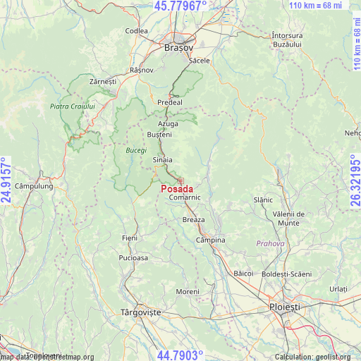
Posada GPS coordinates[2]
45° 17' 13.704" North, 25° 37' 7.752" East
| Map corner | latitude | longitude |
|---|---|---|
| Upper-left | 45.77967°, | 24.9157° |
| Center: | 45.28714°, | 25.61882° |
| Lower-right: | 44.7903°, | 26.32195° |
| Map W x H: | 110×110 km | = 68.4×68.4mi |
| max Lat: | 48.23793° ⇑59.2% North |
| Posada: | 45.28714° |
| min Lat: | ⇓40.8% South 43.65638° |
| min Long | Posada | max Long |
| 20.31667° | 25.61882° | 29.65403° |
| W 56.3%⇐ | ⇒43.7% E |
Elevation
Elevation of Posada is 749 m = 2457 ft, and this is 494.1 m = 1621 ft above average elevation for this country.
| Max E: |
1278 m = 4193 ft | 2.3% |
| Posada | 749 m 2457 ft | |
| Avg. | 254.9 m = 836 ft | |
Min E: |
-2 m = -7 ft | 97.7% |
See also: Romania elevation on elevation.city.
Geographical zone
Posada is located in North temperate zone (between Tropic of Cancer and the Arctic Circle). Distance of this North polar circle is 2365.7 km =1470 mi to North.| Distance of | km | miles | from Posada |
|---|---|---|---|
| North Pole | 4971.6 | 3089.2 | to North |
| Arctic Circle | 2365.7 | 1470 | to North |
| Tropic Cancer | 2429.5 | 1509.6 | to South |
| Equator | 5035.5 | 3128.9 | to South |


Nearby cities:
15 places around Posada: (largest is in red/bold)
• Breaza de Sus
10.2 km =6.3 mi,  163°
163°
• Comarnic
4.3 km =2.7 mi, 164°
• Ghioșești
5 km =3.1 mi,  172°
172°
• Gura Beliei
8.8 km =5.5 mi, 164°
• Nistorești
10.2 km =6.3 mi, 157°
• Ocina de Sus
9.7 km =6 mi,  189°
189°
• Plaiu
7.7 km =4.8 mi, 193°
• Podu Lung
6.2 km =3.9 mi, 159°
• Poiana
5.8 km =3.6 mi,  143°
143°
• Secăria
5.1 km =3.2 mi,  94°
94°
• Sinaia
8.8 km =5.5 mi,  322°
322°
• Talea
8.1 km =5 mi,  211°
211°
• Teșila
8.4 km =5.2 mi,  77°
77°
• Trăisteni
10.3 km =6.4 mi,  56°
56°
• Vistieru
9.6 km =6 mi, 137°
Sources, notices
• [Note1] Compared only with cities in Romania existing in our database
• [Src1] Map data: © OpenStreetMap contributors (CC-BY-SA)
• [Src2] Other city data from geonames.org with taken over terms of usage.
• [Src3] Geographical zone / Annual Mean Temperature by Robert A. Rohde @ Wikipedia
