Mirila geodata
Mirila (Olt) is a populated place; located in Romania in Europe/Bucharest (GMT+3) time zone. With population of 618 people, there are 6085 cities with bigger population in this country. Compared to other cities in Romania, 89.4% of cities are located further ↑North; 66.7% of cities are located further →East and 67.7% of cities have higher elevation than Mirila. Note1


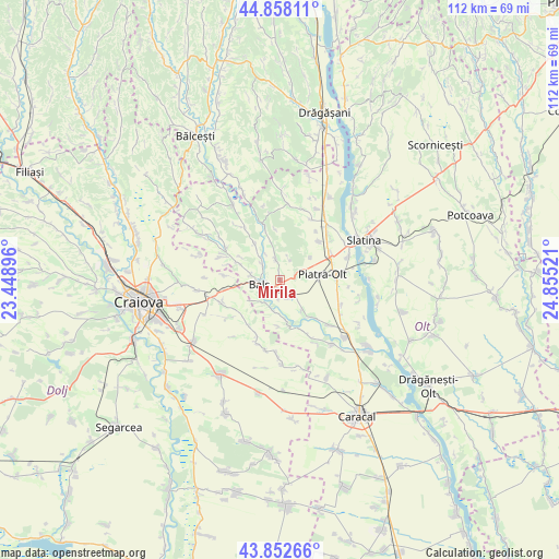
Mirila GPS coordinates[2]
44° 21' 27.144" North, 24° 9' 7.488" East
| Map corner | latitude | longitude |
|---|---|---|
| Upper-left | 44.85811°, | 23.44896° |
| Center: | 44.35754°, | 24.15208° |
| Lower-right: | 43.85266°, | 24.85521° |
| Map W x H: | 111.8×111.8 km | = 69.5×69.5mi |
| max Lat: | 48.23793° ⇑89.4% North |
| Mirila: | 44.35754° |
| min Lat: | ⇓10.6% South 43.65638° |
| min Long | Mirila | max Long |
| 20.31667° | 24.15208° | 29.65403° |
| W 33.3%⇐ | ⇒66.7% E |
Elevation
Elevation of Mirila is 136 m = 446 ft, and this is 118.9 m = 390 ft below average elevation for this country.
| Max E: |
1278 m = 4193 ft | 67.7% |
| Avg. | 254.9 m = 836 ft | |
| Mirila | 136 m = 446 ft | |
Min E: |
-2 m = -7 ft | 32.3% |
See also: Romania elevation on elevation.city.
Geographical zone
Mirila is located in North temperate zone (between Tropic of Cancer and the Arctic Circle). Distance of this Northern Tropic circle is 2326.2 km =1445.4 mi to South.| Distance of | km | miles | from Mirila |
|---|---|---|---|
| North Pole | 5075 | 3153.5 | to North |
| Arctic Circle | 2469.1 | 1534.2 | to North |
| Tropic Cancer | 2326.2 | 1445.4 | to South |
| Equator | 4932.1 | 3064.7 | to South |


Nearby cities:
15 places around Mirila: (largest is in red/bold)
• Baldovineşti
8.6 km =5.3 mi,  289°
289°
• Balş
4.2 km =2.6 mi,  258°
258°
• Bistrița Nouă
7.7 km =4.8 mi,  52°
52°
• Bobiceşti
2.9 km =1.8 mi,  356°
356°
• Braneț
4.1 km =2.5 mi,  149°
149°
• Bârza
3.4 km =2.1 mi,  193°
193°
• Corbeni
4.1 km =2.5 mi,  305°
305°
• Leotești
1 km =0.6 mi,  0°
0°
• Mărgăritești
6.6 km =4.1 mi,  182°
182°
• Oboga
7.8 km =4.8 mi,  327°
327°
• Olari
7.1 km =4.4 mi,  140°
140°
• Pârşcoveni
9.1 km =5.7 mi,  134°
134°
• Racovița
5.3 km =3.3 mi,  208°
208°
• Teiș
1.7 km =1.1 mi,  240°
240°
• Voineasa
8.4 km =5.2 mi, 190°
Sources, notices
• [Note1] Compared only with cities in Romania existing in our database
• [Src1] Map data: © OpenStreetMap contributors (CC-BY-SA)
• [Src2] Other city data from geonames.org with taken over terms of usage.
• [Src3] Geographical zone / Annual Mean Temperature by Robert A. Rohde @ Wikipedia
