Marghita geodata
Marghita (Bihor) is a seat of a second-order administrative division; located in Romania in Europe/Bucharest (GMT+3) time zone. With population of 13,871 people, there are 138 cities with bigger population in this country. Compared to other cities in Romania, 87.6% of cities are located further ↓South; 91.3% of cities are located further →East and 66.8% of cities have higher elevation than Marghita. Note1


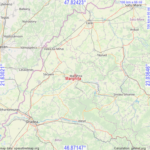
Marghita GPS coordinates[2]
47° 21' 0" North, 22° 19' 59.988" East
| Map corner | latitude | longitude |
|---|---|---|
| Upper-left | 47.82423°, | 21.63021° |
| Center: | 47.35°, | 22.33333° |
| Lower-right: | 46.87147°, | 23.03646° |
| Map W x H: | 105.9×105.9 km | = 65.8×65.8mi |
| max Lat: | 48.23793° ⇑12.4% North |
| Marghita: | 47.35° |
| min Lat: | ⇓87.6% South 43.65638° |
| min Long | Marghita | max Long |
| 20.31667° | 22.33333° | 29.65403° |
| W 8.7%⇐ | ⇒91.3% E |
Elevation
Elevation of Marghita is 140 m = 459 ft, and this is 114.9 m = 377 ft below average elevation for this country.
| Max E: |
1278 m = 4193 ft | 66.8% |
| Avg. | 254.9 m = 836 ft | |
| Marghita | 140 m = 459 ft | |
Min E: |
-2 m = -7 ft | 33.2% |
See also: Romania elevation on elevation.city.
Geographical zone
Marghita is located in North temperate zone (between Tropic of Cancer and the Arctic Circle). Distance of this North polar circle is 2136.3 km =1327.4 mi to North.| Distance of | km | miles | from Marghita |
|---|---|---|---|
| North Pole | 4742.2 | 2946.7 | to North |
| Arctic Circle | 2136.3 | 1327.4 | to North |
| Tropic Cancer | 2658.9 | 1652.2 | to South |
| Equator | 5264.8 | 3271.4 | to South |


Nearby cities:
15 places around Marghita: (largest is in red/bold)
• Abram
5.3 km =3.3 mi,  134°
134°
• Abrămuţ
7.3 km =4.5 mi,  239°
239°
• Albiș
8 km =5 mi,  304°
304°
• Bogei
9.6 km =6 mi,  167°
167°
• Buduslău
7.5 km =4.7 mi,  317°
317°
• Cheț
7.7 km =4.8 mi,  3°
3°
• Chiraleu
5.6 km =3.5 mi,  207°
207°
• Chiribiș
4.4 km =2.7 mi, 171°
• Ciutelec
10.6 km =6.6 mi,  157°
157°
• Ghenetea
6.5 km =4 mi,  48°
48°
• Margine
9.2 km =5.7 mi, 131°
• Petreu
3.1 km =1.9 mi, 243°
• Suiug
8.2 km =5.1 mi,  113°
113°
• Tăuteu
9.3 km =5.8 mi,  180°
180°
• Viişoara
9.5 km =5.9 mi,  67°
67°
Sources, notices
• [Note1] Compared only with cities in Romania existing in our database
• [Src1] Map data: © OpenStreetMap contributors (CC-BY-SA)
• [Src2] Other city data from geonames.org with taken over terms of usage.
• [Src3] Geographical zone / Annual Mean Temperature by Robert A. Rohde @ Wikipedia
