Abrămuţ geodata
Abrămuţ (Bihor) is a seat of a second-order administrative division; located in Romania in Europe/Bucharest (GMT+3) time zone. With population of 2,962 people, there are 1806 cities with bigger population in this country. Compared to other cities in Romania, 86.9% of cities are located further ↓South; 92.4% of cities are located further →East and 72.3% of cities have higher elevation than Abrămuţ. Note1


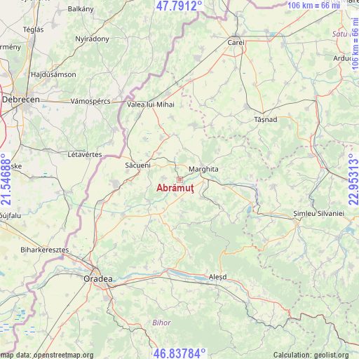
Abrămuţ GPS coordinates[2]
47° 19' 0.012" North, 22° 15' 0" East
| Map corner | latitude | longitude |
|---|---|---|
| Upper-left | 47.7912°, | 21.54688° |
| Center: | 47.31667°, | 22.25° |
| Lower-right: | 46.83784°, | 22.95313° |
| Map W x H: | 106×106 km | = 65.9×65.9mi |
| max Lat: | 48.23793° ⇑13.1% North |
| Abrămuţ: | 47.31667° |
| min Lat: | ⇓86.9% South 43.65638° |
| min Long | Abrămuţ | max Long |
| 20.31667° | 22.25° | 29.65403° |
| W 7.6%⇐ | ⇒92.4% E |
Elevation
Elevation of Abrămuţ is 119 m = 390 ft, and this is 135.9 m = 446 ft below average elevation for this country.
| Max E: |
1278 m = 4193 ft | 72.3% |
| Avg. | 254.9 m = 836 ft | |
| Abrămuţ | 119 m = 390 ft | |
Min E: |
-2 m = -7 ft | 27.7% |
See also: Romania elevation on elevation.city.
Geographical zone
Abrămuţ is located in North temperate zone (between Tropic of Cancer and the Arctic Circle). Distance of this North polar circle is 2140.1 km =1329.8 mi to North.| Distance of | km | miles | from Abrămuţ |
|---|---|---|---|
| North Pole | 4745.9 | 2949 | to North |
| Arctic Circle | 2140.1 | 1329.8 | to North |
| Tropic Cancer | 2655.2 | 1649.9 | to South |
| Equator | 5261.1 | 3269.1 | to South |


Nearby cities:
15 places around Abrămuţ: (largest is in red/bold)
• Abram
10.1 km =6.3 mi,  90°
90°
• Albiș
8.2 km =5.1 mi,  357°
357°
• Buduslău
9.4 km =5.8 mi,  7°
7°
• Chiraleu
3.9 km =2.4 mi,  108°
108°
• Chiribiș
7 km =4.3 mi,  95°
95°
• Chişlaz
3.9 km =2.4 mi,  198°
198°
• Cubulcut
4.8 km =3 mi,  277°
277°
• Marghita
7.3 km =4.5 mi,  59°
59°
• Mișca
6 km =3.7 mi,  173°
173°
• Olosig
6.6 km =4.1 mi,  306°
306°
• Petreu
4.2 km =2.6 mi, 56°
• Sânnicolau de Munte
8.7 km =5.4 mi,  260°
260°
• Tria
9.3 km =5.8 mi, 172°
• Târgușor
9.7 km =6 mi,  319°
319°
• Tăuteu
8.4 km =5.2 mi,  131°
131°
Sources, notices
• [Note1] Compared only with cities in Romania existing in our database
• [Src1] Map data: © OpenStreetMap contributors (CC-BY-SA)
• [Src2] Other city data from geonames.org with taken over terms of usage.
• [Src3] Geographical zone / Annual Mean Temperature by Robert A. Rohde @ Wikipedia
