Leontinești geodata
Leontinești (Bacău) is a populated place; located in Romania in Europe/Bucharest (GMT+3) time zone. With population of 920 people, there are 4542 cities with bigger population in this country. Compared to other cities in Romania, 67.5% of cities are located further ↓South; 74.5% of cities are located further ←West and 75% of cities have lower elevation than Leontinești. Note1


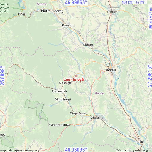
Leontinești GPS coordinates[2]
46° 31' 0.948" North, 26° 35' 34.872" East
| Map corner | latitude | longitude |
|---|---|---|
| Upper-left | 46.99863°, | 25.8899° |
| Center: | 46.51693°, | 26.59302° |
| Lower-right: | 46.03093°, | 27.29615° |
| Map W x H: | 107.6×107.6 km | = 66.9×66.9mi |
| max Lat: | 48.23793° ⇑32.5% North |
| Leontinești: | 46.51693° |
| min Lat: | ⇓67.5% South 43.65638° |
| min Long | Leontinești | max Long |
| 20.31667° | 26.59302° | 29.65403° |
| W 74.5%⇐ | ⇒25.5% E |
Elevation
Elevation of Leontinești is 353 m = 1158 ft, and this is 98.1 m = 322 ft above average elevation for this country.
| Max E: |
1278 m = 4193 ft | 25% |
| Leontinești | 353 m 1158 ft | |
| Avg. | 254.9 m = 836 ft | |
Min E: |
-2 m = -7 ft | 75% |
See also: Romania elevation on elevation.city.
Geographical zone
Leontinești is located in North temperate zone (between Tropic of Cancer and the Arctic Circle). Distance of this North polar circle is 2229 km =1385 mi to North.| Distance of | km | miles | from Leontinești |
|---|---|---|---|
| North Pole | 4834.9 | 3004.3 | to North |
| Arctic Circle | 2229 | 1385 | to North |
| Tropic Cancer | 2566.3 | 1594.6 | to South |
| Equator | 5172.2 | 3213.9 | to South |


Nearby cities:
15 places around Leontinești: (largest is in red/bold)
• Ardeoani
1.9 km =1.2 mi,  16°
16°
• Bucșești
3.8 km =2.4 mi,  192°
192°
• Băhnășeni
6.2 km =3.9 mi,  352°
352°
• Cernu
5.3 km =3.3 mi, 186°
• Florești
5.7 km =3.5 mi,  81°
81°
• Găzărie
6.5 km =4 mi,  241°
241°
• Măgireşti
3.3 km =2.1 mi,  269°
269°
• Prohozești
5 km =3.1 mi,  218°
218°
• Prăjești
5.3 km =3.3 mi,  256°
256°
• Scorţeni
5.7 km =3.5 mi,  49°
49°
• Solonţ
6.9 km =4.3 mi,  302°
302°
• Stănești
4.7 km =2.9 mi,  283°
283°
• Sărata
6.4 km =4 mi,  330°
330°
• Tescani
4.9 km =3 mi,  97°
97°
• Valea Arinilor
6.8 km =4.2 mi,  251°
251°
Sources, notices
• [Note1] Compared only with cities in Romania existing in our database
• [Src1] Map data: © OpenStreetMap contributors (CC-BY-SA)
• [Src2] Other city data from geonames.org with taken over terms of usage.
• [Src3] Geographical zone / Annual Mean Temperature by Robert A. Rohde @ Wikipedia
