Izvoru geodata
Izvoru (Arges) is a seat of a second-order administrative division; located in Romania in Europe/Bucharest (GMT+3) time zone. With population of 2,940 people, there are 1824 cities with bigger population in this country. Compared to other cities in Romania, 85.3% of cities are located further ↑North; 51.8% of cities are located further →East and 59.2% of cities have higher elevation than Izvoru. Note1


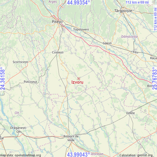
Izvoru GPS coordinates[2]
44° 29' 38.904" North, 25° 3' 52.92" East
| Map corner | latitude | longitude |
|---|---|---|
| Upper-left | 44.99354°, | 24.36158° |
| Center: | 44.49414°, | 25.0647° |
| Lower-right: | 43.99043°, | 25.76783° |
| Map W x H: | 111.5×111.5 km | = 69.3×69.3mi |
| max Lat: | 48.23793° ⇑85.3% North |
| Izvoru: | 44.49414° |
| min Lat: | ⇓14.7% South 43.65638° |
| min Long | Izvoru | max Long |
| 20.31667° | 25.0647° | 29.65403° |
| W 48.2%⇐ | ⇒51.8% E |
Elevation
Elevation of Izvoru is 169 m = 554 ft, and this is 85.9 m = 282 ft below average elevation for this country.
| Max E: |
1278 m = 4193 ft | 59.2% |
| Avg. | 254.9 m = 836 ft | |
| Izvoru | 169 m = 554 ft | |
Min E: |
-2 m = -7 ft | 40.8% |
See also: Romania elevation on elevation.city.
Geographical zone
Izvoru is located in North temperate zone (between Tropic of Cancer and the Arctic Circle). Distance of this Northern Tropic circle is 2341.4 km =1454.9 mi to South.| Distance of | km | miles | from Izvoru |
|---|---|---|---|
| North Pole | 5059.8 | 3144 | to North |
| Arctic Circle | 2453.9 | 1524.8 | to North |
| Tropic Cancer | 2341.4 | 1454.9 | to South |
| Equator | 4947.3 | 3074.1 | to South |


Nearby cities:
15 places around Izvoru: (largest is in red/bold)
• Colțu
10.7 km =6.6 mi,  269°
269°
• Căldăraru
10.3 km =6.4 mi,  241°
241°
• Deagu de Sus
9.1 km =5.7 mi,  329°
329°
• Dobreni
9.6 km =6 mi,  154°
154°
• Găujani
10.3 km =6.4 mi,  302°
302°
• Humele
7.8 km =4.8 mi, 297°
• Mozăceni
11.4 km =7.1 mi,  45°
45°
• Popeşti
6.5 km =4 mi, 154°
• Purcăreni
7.7 km =4.8 mi,  133°
133°
• Recea
5.8 km =3.6 mi,  318°
318°
• Râca
6.9 km =4.3 mi,  194°
194°
• Slobozia
8.4 km =5.2 mi,  142°
142°
• Strâmbeni
7.8 km =4.8 mi,  248°
248°
• Tătărăștii de Sus
10.6 km =6.6 mi, 154°
• Ungheni
7.8 km =4.8 mi, 274°
Sources, notices
• [Note1] Compared only with cities in Romania existing in our database
• [Src1] Map data: © OpenStreetMap contributors (CC-BY-SA)
• [Src2] Other city data from geonames.org with taken over terms of usage.
• [Src3] Geographical zone / Annual Mean Temperature by Robert A. Rohde @ Wikipedia
