Izvoarele geodata
Izvoarele (Giurgiu) is a seat of a second-order administrative division; located in Romania in Europe/Bucharest (GMT+3) time zone. With population of 4,753 people, there are 857 cities with bigger population in this country. Compared to other cities in Romania, 96.4% of cities are located further ↑North; 58.7% of cities are located further ←West and 84.4% of cities have higher elevation than Izvoarele. Note1


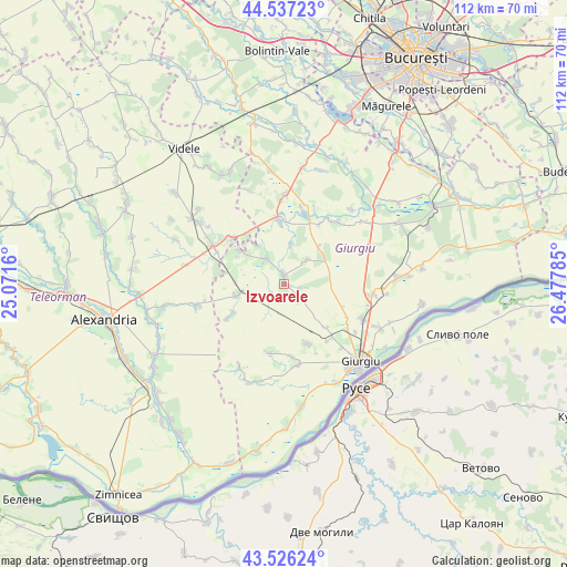
Izvoarele GPS coordinates[2]
44° 2' 2.004" North, 25° 46' 28.992" East
| Map corner | latitude | longitude |
|---|---|---|
| Upper-left | 44.53723°, | 25.0716° |
| Center: | 44.03389°, | 25.77472° |
| Lower-right: | 43.52624°, | 26.47785° |
| Map W x H: | 112.4×112.4 km | = 69.8×69.8mi |
| max Lat: | 48.23793° ⇑96.4% North |
| Izvoarele: | 44.03389° |
| min Lat: | ⇓3.6% South 43.65638° |
| min Long | Izvoarele | max Long |
| 20.31667° | 25.77472° | 29.65403° |
| W 58.7%⇐ | ⇒41.3% E |
Elevation
Elevation of Izvoarele is 80 m = 262 ft, and this is 174.9 m = 574 ft below average elevation for this country.
| Max E: |
1278 m = 4193 ft | 84.4% |
| Avg. | 254.9 m = 836 ft | |
| Izvoarele | 80 m = 262 ft | |
Min E: |
-2 m = -7 ft | 15.6% |
See also: Romania elevation on elevation.city.
Geographical zone
Izvoarele is located in North temperate zone (between Tropic of Cancer and the Arctic Circle). Distance of this Northern Tropic circle is 2290.2 km =1423.1 mi to South.| Distance of | km | miles | from Izvoarele |
|---|---|---|---|
| North Pole | 5111 | 3175.8 | to North |
| Arctic Circle | 2505.1 | 1556.6 | to North |
| Tropic Cancer | 2290.2 | 1423.1 | to South |
| Equator | 4896.1 | 3042.3 | to South |


Nearby cities:
15 places around Izvoarele: (largest is in red/bold)
• Bujoreni
14.6 km =9.1 mi,  309°
309°
• Chiriacu
1.8 km =1.1 mi,  6°
6°
• Cucuruzu
6.2 km =3.9 mi,  326°
326°
• Ghizdaru
14.3 km =8.9 mi,  142°
142°
• Hodivoaia
14.6 km =9.1 mi,  173°
173°
• Naipu
13.2 km =8.2 mi,  355°
355°
• Oncești
12.1 km =7.5 mi, 135°
• Prunaru
12.6 km =7.8 mi,  322°
322°
• Răsuceni
10.9 km =6.8 mi, 305°
• Schitu
12.9 km =8 mi,  22°
22°
• Stăneşti
13.9 km =8.6 mi,  160°
160°
• Tomulești
12.7 km =7.9 mi,  240°
240°
• Toporu
10.1 km =6.3 mi,  255°
255°
• Valea Bujorului
6.7 km =4.2 mi,  44°
44°
• Vlașin
9.9 km =6.2 mi, 42°
Sources, notices
• [Note1] Compared only with cities in Romania existing in our database
• [Src1] Map data: © OpenStreetMap contributors (CC-BY-SA)
• [Src2] Other city data from geonames.org with taken over terms of usage.
• [Src3] Geographical zone / Annual Mean Temperature by Robert A. Rohde @ Wikipedia
