Iernuțeni geodata
Iernuțeni (Mureş) is a section of populated place; located in Romania in Europe/Bucharest (GMT+3) time zone. With population of 1,373 people, there are 3388 cities with bigger population in this country. Compared to other cities in Romania, 73.1% of cities are located further ↓South; 56.8% of cities are located further →East and 76% of cities have lower elevation than Iernuțeni. Note1


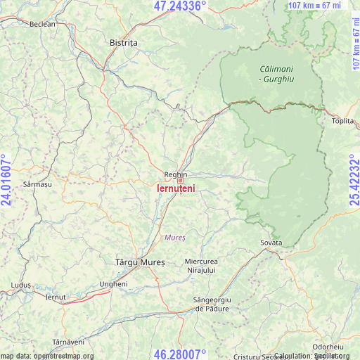
Iernuțeni GPS coordinates[2]
46° 45' 49.932" North, 24° 43' 9.084" East
| Map corner | latitude | longitude |
|---|---|---|
| Upper-left | 47.24336°, | 24.01607° |
| Center: | 46.76387°, | 24.71919° |
| Lower-right: | 46.28007°, | 25.42232° |
| Map W x H: | 107.1×107.1 km | = 66.5×66.5mi |
| max Lat: | 48.23793° ⇑26.9% North |
| Iernuțeni: | 46.76387° |
| min Lat: | ⇓73.1% South 43.65638° |
| min Long | Iernuțeni | max Long |
| 20.31667° | 24.71919° | 29.65403° |
| W 43.2%⇐ | ⇒56.8% E |
Elevation
Elevation of Iernuțeni is 361 m = 1184 ft, and this is 106.1 m = 348 ft above average elevation for this country.
| Max E: |
1278 m = 4193 ft | 24% |
| Iernuțeni | 361 m 1184 ft | |
| Avg. | 254.9 m = 836 ft | |
Min E: |
-2 m = -7 ft | 76% |
See also: Romania elevation on elevation.city.
Geographical zone
Iernuțeni is located in North temperate zone (between Tropic of Cancer and the Arctic Circle). Distance of this North polar circle is 2201.5 km =1367.9 mi to North.| Distance of | km | miles | from Iernuțeni |
|---|---|---|---|
| North Pole | 4807.4 | 2987.2 | to North |
| Arctic Circle | 2201.5 | 1367.9 | to North |
| Tropic Cancer | 2593.7 | 1611.6 | to South |
| Equator | 5199.7 | 3230.9 | to South |


Nearby cities:
15 places around Iernuțeni: (largest is in red/bold)
• Apalina
2.3 km =1.4 mi,  235°
235°
• Beica de Jos
7 km =4.3 mi,  118°
118°
• Breaza
6.5 km =4 mi,  272°
272°
• Dedrad
8.4 km =5.2 mi,  326°
326°
• Filpișu Mare
9.9 km =6.2 mi,  263°
263°
• Ideciu de Jos
4.7 km =2.9 mi,  30°
30°
• Jabenița
6.3 km =3.9 mi,  69°
69°
• Luieriu
9.6 km =6 mi,  358°
358°
• Petelea
4 km =2.5 mi,  193°
193°
• Petrilaca de Mureș
8.6 km =5.3 mi,  162°
162°
• Reghin
1.7 km =1.1 mi,  311°
311°
• Reghin-Sat
2.2 km =1.4 mi,  354°
354°
• Solovăstru
3.6 km =2.2 mi,  85°
85°
• Suseni
5.6 km =3.5 mi,  9°
9°
• Voivodeni
9.7 km =6 mi,  222°
222°
Sources, notices
• [Note1] Compared only with cities in Romania existing in our database
• [Src1] Map data: © OpenStreetMap contributors (CC-BY-SA)
• [Src2] Other city data from geonames.org with taken over terms of usage.
• [Src3] Geographical zone / Annual Mean Temperature by Robert A. Rohde @ Wikipedia
