Horgeşti geodata
Horgeşti (Bacău) is a seat of a second-order administrative division; located in Romania in Europe/Bucharest (GMT+3) time zone. With population of 4,665 people, there are 893 cities with bigger population in this country. Compared to other cities in Romania, 65.4% of cities are located further ↓South; 84.2% of cities are located further ←West and 53.4% of cities have lower elevation than Horgeşti. Note1


Horgeşti GPS coordinates[2]
46° 25' 59.988" North, 27° 4' 0.012" East
| Map corner | latitude | longitude |
|---|---|---|
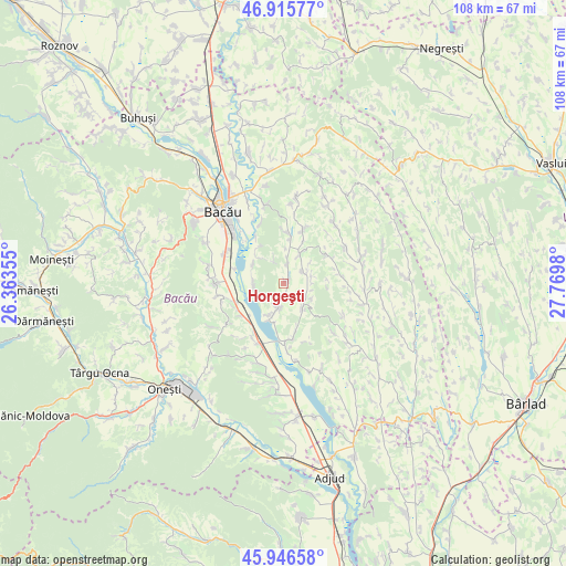
| Upper-left | 46.91577°, | 26.36355° |
| Center: | 46.43333°, | 27.06667° |
| Lower-right: | 45.94658°, | 27.7698° |
| Map W x H: | 107.8×107.8 km | = 67×67mi |
| max Lat: | 48.23793° ⇑34.6% North |
| Horgeşti: | 46.43333° |
| min Lat: | ⇓65.4% South 43.65638° |
| min Long | Horgeşti | max Long |
| 20.31667° | 27.06667° | 29.65403° |
| W 84.2%⇐ | ⇒15.8% E |
Elevation
Elevation of Horgeşti is 230 m = 755 ft, and this is 24.9 m = 82 ft below average elevation for this country.
| Max E: |
1278 m = 4193 ft | 46.6% |
| Avg. | 254.9 m = 836 ft | |
| Horgeşti | 230 m = 755 ft | |
Min E: |
-2 m = -7 ft | 53.4% |
See also: Romania elevation on elevation.city.
Geographical zone
Horgeşti is located in North temperate zone (between Tropic of Cancer and the Arctic Circle). Distance of this North polar circle is 2238.3 km =1390.8 mi to North.| Distance of | km | miles | from Horgeşti |
|---|---|---|---|
| North Pole | 4844.2 | 3010 | to North |
| Arctic Circle | 2238.3 | 1390.8 | to North |
| Tropic Cancer | 2557 | 1588.8 | to South |
| Equator | 5162.9 | 3208.1 | to South |


Nearby cities:
15 places around Horgeşti: (largest is in red/bold)
• Bazga
6.8 km =4.2 mi,  208°
208°
• Bibirești
9.5 km =5.9 mi,  5°
5°
• Chetriș
6.8 km =4.2 mi,  302°
302°
• Furnicari
9.8 km =6.1 mi,  327°
327°
• Galbeni
9.6 km =6 mi,  285°
285°
• Gioseni
5.7 km =3.5 mi,  265°
265°
• Nănești
4.3 km =2.7 mi,  56°
56°
• Parincea
6.1 km =3.8 mi,  24°
24°
• Petrești
6.3 km =3.9 mi,  144°
144°
• Recea
4.8 km =3 mi,  191°
191°
• Soci
5.9 km =3.7 mi,  118°
118°
• Sohodor
2.9 km =1.8 mi, 185°
• Tamaşi
8.5 km =5.3 mi,  311°
311°
• Vladnic
5.6 km =3.5 mi,  76°
76°
• Văleni
3.7 km =2.3 mi, 12°
Sources, notices
• [Note1] Compared only with cities in Romania existing in our database
• [Src1] Map data: © OpenStreetMap contributors (CC-BY-SA)
• [Src2] Other city data from geonames.org with taken over terms of usage.
• [Src3] Geographical zone / Annual Mean Temperature by Robert A. Rohde @ Wikipedia
