Goreni geodata
Goreni (Mureş) is a populated place; located in Romania in Europe/Bucharest (GMT+3) time zone. With population of 1,040 people, there are 4154 cities with bigger population in this country. Compared to other cities in Romania, 75.5% of cities are located further ↓South; 57.9% of cities are located further →East and 80.3% of cities have lower elevation than Goreni. Note1


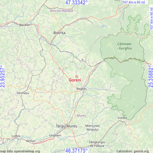
Goreni GPS coordinates[2]
46° 51' 17.064" North, 24° 39' 20.484" East
| Map corner | latitude | longitude |
|---|---|---|
| Upper-left | 47.33342°, | 23.95257° |
| Center: | 46.85474°, | 24.65569° |
| Lower-right: | 46.37175°, | 25.35882° |
| Map W x H: | 106.9×106.9 km | = 66.4×66.4mi |
| max Lat: | 48.23793° ⇑24.5% North |
| Goreni: | 46.85474° |
| min Lat: | ⇓75.5% South 43.65638° |
| min Long | Goreni | max Long |
| 20.31667° | 24.65569° | 29.65403° |
| W 42.1%⇐ | ⇒57.9% E |
Elevation
Elevation of Goreni is 396 m = 1299 ft, and this is 141.1 m = 463 ft above average elevation for this country.
| Max E: |
1278 m = 4193 ft | 19.7% |
| Goreni | 396 m 1299 ft | |
| Avg. | 254.9 m = 836 ft | |
Min E: |
-2 m = -7 ft | 80.3% |
See also: Romania elevation on elevation.city.
Geographical zone
Goreni is located in North temperate zone (between Tropic of Cancer and the Arctic Circle). Distance of this North polar circle is 2191.4 km =1361.7 mi to North.| Distance of | km | miles | from Goreni |
|---|---|---|---|
| North Pole | 4797.3 | 2980.9 | to North |
| Arctic Circle | 2191.4 | 1361.7 | to North |
| Tropic Cancer | 2603.8 | 1617.9 | to South |
| Equator | 5209.8 | 3237.2 | to South |


Nearby cities:
15 places around Goreni: (largest is in red/bold)
• Batoş
3.3 km =2.1 mi,  14°
14°
• Breaza
9.9 km =6.2 mi,  189°
189°
• Brâncoveneşti
7.9 km =4.9 mi,  88°
88°
• Băița
9.8 km =6.1 mi,  257°
257°
• Cozma
10.2 km =6.3 mi,  245°
245°
• Dedrad
3.2 km =2 mi,  176°
176°
• Frunzeni
8 km =5 mi,  236°
236°
• Ideciu de Jos
9.4 km =5.8 mi,  130°
130°
• Logig
6.8 km =4.2 mi,  293°
293°
• Luieriu
4.7 km =2.9 mi,  96°
96°
• Lunca
6.8 km =4.2 mi,  265°
265°
• Reghin
9.6 km =6 mi,  158°
158°
• Reghin-Sat
9.2 km =5.7 mi,  149°
149°
• Suseni
7.4 km =4.6 mi, 128°
• Uila
9 km =5.6 mi,  341°
341°
Sources, notices
• [Note1] Compared only with cities in Romania existing in our database
• [Src1] Map data: © OpenStreetMap contributors (CC-BY-SA)
• [Src2] Other city data from geonames.org with taken over terms of usage.
• [Src3] Geographical zone / Annual Mean Temperature by Robert A. Rohde @ Wikipedia
