Glâmbocelu geodata
Glâmbocelu (Arges) is a populated place; located in Romania in Europe/Bucharest (GMT+3) time zone. With population of 828 people, there are 4924 cities with bigger population in this country. Compared to other cities in Romania, 75.2% of cities are located further ↑North; 50.7% of cities are located further →East and 59.5% of cities have lower elevation than Glâmbocelu. Note1


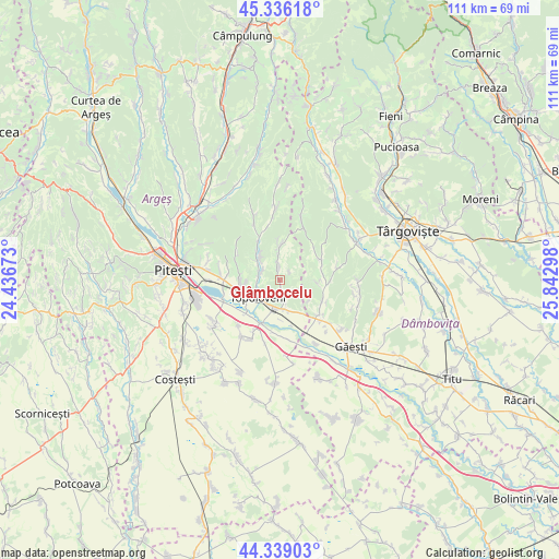
Glâmbocelu GPS coordinates[2]
44° 50' 23.136" North, 25° 8' 23.46" East
| Map corner | latitude | longitude |
|---|---|---|
| Upper-left | 45.33618°, | 24.43673° |
| Center: | 44.83976°, | 25.13985° |
| Lower-right: | 44.33903°, | 25.84298° |
| Map W x H: | 110.9×110.9 km | = 68.9×68.9mi |
| max Lat: | 48.23793° ⇑75.2% North |
| Glâmbocelu: | 44.83976° |
| min Lat: | ⇓24.8% South 43.65638° |
| min Long | Glâmbocelu | max Long |
| 20.31667° | 25.13985° | 29.65403° |
| W 49.3%⇐ | ⇒50.7% E |
Elevation
Elevation of Glâmbocelu is 261 m = 856 ft, and this is 6.1 m = 20 ft above average elevation for this country.
| Max E: |
1278 m = 4193 ft | 40.5% |
| Glâmbocelu | 261 m 856 ft | |
| Avg. | 254.9 m = 836 ft | |
Min E: |
-2 m = -7 ft | 59.5% |
See also: Romania elevation on elevation.city.
Geographical zone
Glâmbocelu is located in North temperate zone (between Tropic of Cancer and the Arctic Circle). Distance of this Northern Tropic circle is 2379.8 km =1478.7 mi to South.| Distance of | km | miles | from Glâmbocelu |
|---|---|---|---|
| North Pole | 5021.3 | 3120.1 | to North |
| Arctic Circle | 2415.5 | 1500.9 | to North |
| Tropic Cancer | 2379.8 | 1478.7 | to South |
| Equator | 4985.7 | 3098 | to South |


Nearby cities:
15 places around Glâmbocelu: (largest is in red/bold)
• Bogaţi
3 km =1.9 mi,  350°
350°
• Ciulnița
5.9 km =3.7 mi,  169°
169°
• Călineşti
7.5 km =4.7 mi,  250°
250°
• Glâmbocata-Deal
7.1 km =4.4 mi,  154°
154°
• Hulubeşti
7.4 km =4.6 mi,  95°
95°
• Leordeni
6.5 km =4 mi,  196°
196°
• Ludeşti
8 km =5 mi,  67°
67°
• Măgura
7.6 km =4.7 mi,  94°
94°
• Paraschivești
5.9 km =3.7 mi,  319°
319°
• Pitoi
6.6 km =4.1 mi, 317°
• Priboieni
6.6 km =4.1 mi, 317°
• Schitu Scoicești
2.7 km =1.7 mi,  162°
162°
• Suseni
6.8 km =4.2 mi,  2°
2°
• Topoloveni
5.1 km =3.2 mi,  240°
240°
• Valea Popii
5.2 km =3.2 mi,  306°
306°
Sources, notices
• [Note1] Compared only with cities in Romania existing in our database
• [Src1] Map data: © OpenStreetMap contributors (CC-BY-SA)
• [Src2] Other city data from geonames.org with taken over terms of usage.
• [Src3] Geographical zone / Annual Mean Temperature by Robert A. Rohde @ Wikipedia
