Cluj-Napoca geodata
Cluj-Napoca (Cluj) is a seat of a first-order administrative division; located in Romania in Europe/Bucharest (GMT+3) time zone. With population of 316,748 people, there are 5 cities with bigger population in this country. Compared to other cities in Romania, 73.2% of cities are located further ↓South; 75.6% of cities are located further →East and 74.9% of cities have lower elevation than Cluj-Napoca. Note1


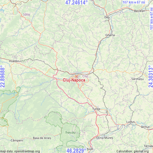
Cluj-Napoca GPS coordinates[2]
46° 46' 0.012" North, 23° 36' 0" East
| Map corner | latitude | longitude |
|---|---|---|
| Upper-left | 47.24614°, | 22.89688° |
| Center: | 46.76667°, | 23.6° |
| Lower-right: | 46.2829°, | 24.30313° |
| Map W x H: | 107.1×107.1 km | = 66.5×66.5mi |
| max Lat: | 48.23793° ⇑26.8% North |
| Cluj-Napoca: | 46.76667° |
| min Lat: | ⇓73.2% South 43.65638° |
| min Long | Cluj-Napoca | max Long |
| 20.31667° | 23.6° | 29.65403° |
| W 24.4%⇐ | ⇒75.6% E |
Elevation
Elevation of Cluj-Napoca is 352 m = 1155 ft, and this is 97.1 m = 319 ft above average elevation for this country.
| Max E: |
1278 m = 4193 ft | 25.1% |
| Cluj-Napoca | 352 m 1155 ft | |
| Avg. | 254.9 m = 836 ft | |
Min E: |
-2 m = -7 ft | 74.9% |
See also: Cluj-Napoca elevation on elevation.city.
Geographical zone
Cluj-Napoca is located in North temperate zone (between Tropic of Cancer and the Arctic Circle). Distance of this North polar circle is 2201.2 km =1367.8 mi to North.| Distance of | km | miles | from Cluj-Napoca |
|---|---|---|---|
| North Pole | 4807.1 | 2987 | to North |
| Arctic Circle | 2201.2 | 1367.8 | to North |
| Tropic Cancer | 2594 | 1611.8 | to South |
| Equator | 5200 | 3231.1 | to South |


Nearby cities:
15 places around Cluj-Napoca: (largest is in red/bold)
• Apahida
12.7 km =7.9 mi,  64°
64°
• Baciu
7.3 km =4.5 mi,  300°
300°
• Chinteni
12.2 km =7.6 mi,  335°
335°
• Corușu
11.6 km =7.2 mi,  319°
319°
• Dezmir
9.5 km =5.9 mi,  91°
91°
• Feleacu
5.7 km =3.5 mi,  167°
167°
• Floreşti
8.4 km =5.2 mi,  253°
253°
• Gheorghieni
8.9 km =5.5 mi,  131°
131°
• Mera
12.4 km =7.7 mi, 295°
• Pata
12 km =7.5 mi,  111°
111°
• Popești
8.1 km =5 mi, 322°
• Rediu
11.8 km =7.3 mi,  143°
143°
• Suceagu
10.5 km =6.5 mi,  280°
280°
• Sânnicoară
9.9 km =6.2 mi,  74°
74°
• Vâlcele
9.8 km =6.1 mi,  155°
155°
In other languages:
- In Spanish: Cluj, Cluj-Napoca
- In German: Klausenburg
- In Russian: Клуж-Напока
- In Chinese: 克卢日-纳波卡
Sources, notices
• [Note1] Compared only with cities in Romania existing in our database
• [Src1] Map data: © OpenStreetMap contributors (CC-BY-SA)
• [Src2] Other city data from geonames.org with taken over terms of usage.
• [Src3] Geographical zone / Annual Mean Temperature by Robert A. Rohde @ Wikipedia
