Cârjoaia geodata
Cârjoaia (Iaşi) is a populated place; located in Romania in Europe/Bucharest (GMT+3) time zone. With population of 1,854 people, there are 2759 cities with bigger population in this country. Compared to other cities in Romania, 87.5% of cities are located further ↓South; 81.2% of cities are located further ←West and 59.5% of cities have higher elevation than Cârjoaia. Note1


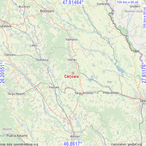
Cârjoaia GPS coordinates[2]
47° 20' 25.152" North, 26° 54' 31.068" East
| Map corner | latitude | longitude |
|---|---|---|
| Upper-left | 47.81464°, | 26.20551° |
| Center: | 47.34032°, | 26.90863° |
| Lower-right: | 46.8617°, | 27.61176° |
| Map W x H: | 106×106 km | = 65.9×65.9mi |
| max Lat: | 48.23793° ⇑12.5% North |
| Cârjoaia: | 47.34032° |
| min Lat: | ⇓87.5% South 43.65638° |
| min Long | Cârjoaia | max Long |
| 20.31667° | 26.90863° | 29.65403° |
| W 81.2%⇐ | ⇒18.8% E |
Elevation
Elevation of Cârjoaia is 168 m = 551 ft, and this is 86.9 m = 285 ft below average elevation for this country.
| Max E: |
1278 m = 4193 ft | 59.5% |
| Avg. | 254.9 m = 836 ft | |
| Cârjoaia | 168 m = 551 ft | |
Min E: |
-2 m = -7 ft | 40.5% |
See also: Romania elevation on elevation.city.
Geographical zone
Cârjoaia is located in North temperate zone (between Tropic of Cancer and the Arctic Circle). Distance of this North polar circle is 2137.4 km =1328.1 mi to North.| Distance of | km | miles | from Cârjoaia |
|---|---|---|---|
| North Pole | 4743.3 | 2947.3 | to North |
| Arctic Circle | 2137.4 | 1328.1 | to North |
| Tropic Cancer | 2657.8 | 1651.5 | to South |
| Equator | 5263.8 | 3270.8 | to South |


Nearby cities:
15 places around Cârjoaia: (largest is in red/bold)
• Balș
7.2 km =4.5 mi,  132°
132°
• Buhalnița
4.3 km =2.7 mi,  6°
6°
• Bădeni
7.9 km =4.9 mi,  22°
22°
• Cepleniţa
9.4 km =5.8 mi,  59°
59°
• Cotnari
5.7 km =3.5 mi,  79°
79°
• Crivești
9.7 km =6 mi,  259°
259°
• Cucuteni
6.6 km =4.1 mi,  163°
163°
• Fetești
7.7 km =4.8 mi,  0°
0°
• Hodora
8.4 km =5.2 mi,  92°
92°
• Horodiștea
1.5 km =0.9 mi, 3°
• Poiana Mărului
4.5 km =2.8 mi,  344°
344°
• Scobinţi
5.1 km =3.2 mi, 21°
• Sticlăria
8.6 km =5.3 mi,  321°
321°
• Todireşti
6.3 km =3.9 mi,  245°
245°
• Zagavia
8.8 km =5.5 mi,  354°
354°
Sources, notices
• [Note1] Compared only with cities in Romania existing in our database
• [Src1] Map data: © OpenStreetMap contributors (CC-BY-SA)
• [Src2] Other city data from geonames.org with taken over terms of usage.
• [Src3] Geographical zone / Annual Mean Temperature by Robert A. Rohde @ Wikipedia
