Izvoarele geodata
Izvoarele (Mehedinţi) is a populated place; located in Romania in Europe/Bucharest (GMT+3) time zone. With population of 1,231 people, there are 3675 cities with bigger population in this country. Compared to other cities in Romania, 90.5% of cities are located further ↑North; 88.5% of cities are located further →East and 86.8% of cities have higher elevation than Izvoarele. Note1


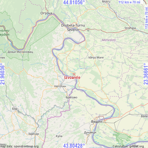
Izvoarele GPS coordinates[2]
44° 18' 34.488" North, 22° 39' 48.528" East
| Map corner | latitude | longitude |
|---|---|---|
| Upper-left | 44.81056°, | 21.96036° |
| Center: | 44.30958°, | 22.66348° |
| Lower-right: | 43.80428°, | 23.36661° |
| Map W x H: | 111.9×111.9 km | = 69.5×69.5mi |
| max Lat: | 48.23793° ⇑90.5% North |
| Izvoarele: | 44.30958° |
| min Lat: | ⇓9.5% South 43.65638° |
| min Long | Izvoarele | max Long |
| 20.31667° | 22.66348° | 29.65403° |
| W 11.5%⇐ | ⇒88.5% E |
Elevation
Elevation of Izvoarele is 72 m = 236 ft, and this is 182.9 m = 600 ft below average elevation for this country.
| Max E: |
1278 m = 4193 ft | 86.8% |
| Avg. | 254.9 m = 836 ft | |
| Izvoarele | 72 m = 236 ft | |
Min E: |
-2 m = -7 ft | 13.2% |
See also: Romania elevation on elevation.city.
Geographical zone
Izvoarele is located in North temperate zone (between Tropic of Cancer and the Arctic Circle). Distance of this Northern Tropic circle is 2320.8 km =1442.1 mi to South.| Distance of | km | miles | from Izvoarele |
|---|---|---|---|
| North Pole | 5080.3 | 3156.8 | to North |
| Arctic Circle | 2474.4 | 1537.5 | to North |
| Tropic Cancer | 2320.8 | 1442.1 | to South |
| Equator | 4926.8 | 3061.4 | to South |


Nearby cities:
15 places around Izvoarele: (largest is in red/bold)
• Balta Verde
6.4 km =4 mi,  306°
306°
• Burila Mică
13.7 km =8.5 mi,  333°
333°
• Cioroboreni
11.9 km =7.4 mi,  42°
42°
• Cozia
11.3 km =7 mi,  159°
159°
• Dănceu
7.6 km =4.7 mi, 36°
• Gogoşu
9.1 km =5.7 mi,  321°
321°
• Gruia
5.7 km =3.5 mi,  144°
144°
• Gârla-Mare
14.3 km =8.9 mi, 141°
• Jiana
11 km =6.8 mi,  20°
20°
• Jiana Mare
11.5 km =7.1 mi,  10°
10°
• Jiana Veche
9 km =5.6 mi,  2°
2°
• Ostrovu Mare
14.1 km =8.8 mi,  303°
303°
• Pristol
10.1 km =6.3 mi, 158°
• Pătulele
9.6 km =6 mi,  65°
65°
• Viașu
13.8 km =8.6 mi, 68°
Sources, notices
• [Note1] Compared only with cities in Romania existing in our database
• [Src1] Map data: © OpenStreetMap contributors (CC-BY-SA)
• [Src2] Other city data from geonames.org with taken over terms of usage.
• [Src3] Geographical zone / Annual Mean Temperature by Robert A. Rohde @ Wikipedia
