Beudiu geodata
Beudiu (Bistriţa-Năsăud) is a populated place; located in Romania in Europe/Bucharest (GMT+3) time zone. With population of 710 people, there are 5507 cities with bigger population in this country. Compared to other cities in Romania, 80.5% of cities are located further ↓South; 66.4% of cities are located further →East and 67.6% of cities have lower elevation than Beudiu. Note1


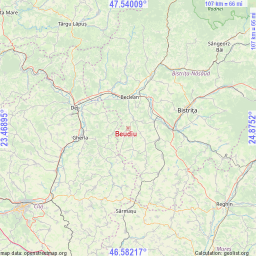
Beudiu GPS coordinates[2]
47° 3' 47.808" North, 24° 10' 19.452" East
| Map corner | latitude | longitude |
|---|---|---|
| Upper-left | 47.54009°, | 23.46895° |
| Center: | 47.06328°, | 24.17207° |
| Lower-right: | 46.58217°, | 24.8752° |
| Map W x H: | 106.5×106.5 km | = 66.2×66.2mi |
| max Lat: | 48.23793° ⇑19.5% North |
| Beudiu: | 47.06328° |
| min Lat: | ⇓80.5% South 43.65638° |
| min Long | Beudiu | max Long |
| 20.31667° | 24.17207° | 29.65403° |
| W 33.6%⇐ | ⇒66.4% E |
Elevation
Elevation of Beudiu is 305 m = 1001 ft, and this is 50.1 m = 164 ft above average elevation for this country.
| Max E: |
1278 m = 4193 ft | 32.4% |
| Beudiu | 305 m 1001 ft | |
| Avg. | 254.9 m = 836 ft | |
Min E: |
-2 m = -7 ft | 67.6% |
See also: Romania elevation on elevation.city.
Geographical zone
Beudiu is located in North temperate zone (between Tropic of Cancer and the Arctic Circle). Distance of this North polar circle is 2168.2 km =1347.3 mi to North.| Distance of | km | miles | from Beudiu |
|---|---|---|---|
| North Pole | 4774.1 | 2966.5 | to North |
| Arctic Circle | 2168.2 | 1347.3 | to North |
| Tropic Cancer | 2627 | 1632.3 | to South |
| Equator | 5232.9 | 3251.6 | to South |


Nearby cities:
15 places around Beudiu: (largest is in red/bold)
• Batin
8.4 km =5.2 mi,  277°
277°
• Bozieș
3.6 km =2.2 mi,  155°
155°
• Chintelnic
13.2 km =8.2 mi,  71°
71°
• Chiochiş
8.9 km =5.5 mi,  174°
174°
• Chiraleș
11.2 km =7 mi,  75°
75°
• Cireșoaia
12.1 km =7.5 mi,  316°
316°
• Corvinești
8.4 km =5.2 mi,  127°
127°
• Cutca
7.8 km =4.8 mi,  243°
243°
• Malin
6.7 km =4.2 mi,  336°
336°
• Matei
11.4 km =7.1 mi,  141°
141°
• Măluț
13.2 km =8.2 mi, 337°
• Nuşeni
4.6 km =2.9 mi,  27°
27°
• Sânmărtin
9.3 km =5.8 mi,  229°
229°
• Unguraş
11 km =6.8 mi,  302°
302°
• Vermeș
13 km =8.1 mi,  122°
122°
Sources, notices
• [Note1] Compared only with cities in Romania existing in our database
• [Src1] Map data: © OpenStreetMap contributors (CC-BY-SA)
• [Src2] Other city data from geonames.org with taken over terms of usage.
• [Src3] Geographical zone / Annual Mean Temperature by Robert A. Rohde @ Wikipedia
