Botești geodata
Botești (Bacău) is a populated place; located in Romania in Europe/Bucharest (GMT+3) time zone. With population of 544 people, there are 6641 cities with bigger population in this country. Compared to other cities in Romania, 68.7% of cities are located further ↓South; 84.9% of cities are located further ←West and 63% of cities have lower elevation than Botești. Note1


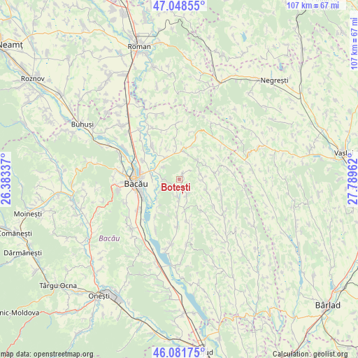
Botești GPS coordinates[2]
46° 34' 2.28" North, 27° 5' 11.364" East
| Map corner | latitude | longitude |
|---|---|---|
| Upper-left | 47.04855°, | 26.38337° |
| Center: | 46.5673°, | 27.08649° |
| Lower-right: | 46.08175°, | 27.78962° |
| Map W x H: | 107.5×107.5 km | = 66.8×66.8mi |
| max Lat: | 48.23793° ⇑31.3% North |
| Botești: | 46.5673° |
| min Lat: | ⇓68.7% South 43.65638° |
| min Long | Botești | max Long |
| 20.31667° | 27.08649° | 29.65403° |
| W 84.9%⇐ | ⇒15.1% E |
Elevation
Elevation of Botești is 279 m = 915 ft, and this is 24.1 m = 79 ft above average elevation for this country.
| Max E: |
1278 m = 4193 ft | 37% |
| Botești | 279 m 915 ft | |
| Avg. | 254.9 m = 836 ft | |
Min E: |
-2 m = -7 ft | 63% |
See also: Romania elevation on elevation.city.
Geographical zone
Botești is located in North temperate zone (between Tropic of Cancer and the Arctic Circle). Distance of this North polar circle is 2223.4 km =1381.6 mi to North.| Distance of | km | miles | from Botești |
|---|---|---|---|
| North Pole | 4829.3 | 3000.8 | to North |
| Arctic Circle | 2223.4 | 1381.6 | to North |
| Tropic Cancer | 2571.9 | 1598.1 | to South |
| Equator | 5177.8 | 3217.3 | to South |


Nearby cities:
15 places around Botești: (largest is in red/bold)
• Bibirești
5.5 km =3.4 mi,  187°
187°
• Bijghir
6.5 km =4 mi,  306°
306°
• Buhoci
5.3 km =3.3 mi,  269°
269°
• Filipeni
8.3 km =5.2 mi,  117°
117°
• Furnicari
9.4 km =5.8 mi,  225°
225°
• Holt
8.6 km =5.3 mi,  278°
278°
• Izvoru Berheciului
10.1 km =6.3 mi,  79°
79°
• Letea Veche
10.6 km =6.6 mi,  259°
259°
• Parincea
9.4 km =5.8 mi,  173°
173°
• Secuieni
9.3 km =5.8 mi,  6°
6°
• Tisa-Silvestri
10.4 km =6.5 mi,  23°
23°
• Traian
8.4 km =5.2 mi,  331°
331°
• Ungureni
5.3 km =3.3 mi,  158°
158°
• Ungureni
11.9 km =7.4 mi,  241°
241°
• Văleni
11.3 km =7 mi,  183°
183°
Sources, notices
• [Note1] Compared only with cities in Romania existing in our database
• [Src1] Map data: © OpenStreetMap contributors (CC-BY-SA)
• [Src2] Other city data from geonames.org with taken over terms of usage.
• [Src3] Geographical zone / Annual Mean Temperature by Robert A. Rohde @ Wikipedia
