Izvoru Berheciului geodata
Izvoru Berheciului (Bacău) is a seat of a second-order administrative division; located in Romania in Europe/Bucharest (GMT+3) time zone. With population of 1,697 people, there are 2926 cities with bigger population in this country. Compared to other cities in Romania, 69% of cities are located further ↓South; 87% of cities are located further ←West and 54.1% of cities have lower elevation than Izvoru Berheciului. Note1


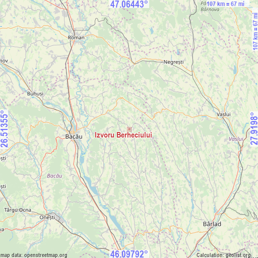
Izvoru Berheciului GPS coordinates[2]
46° 34' 59.988" North, 27° 13' 0.012" East
| Map corner | latitude | longitude |
|---|---|---|
| Upper-left | 47.06443°, | 26.51355° |
| Center: | 46.58333°, | 27.21667° |
| Lower-right: | 46.09792°, | 27.9198° |
| Map W x H: | 107.5×107.5 km | = 66.8×66.8mi |
| max Lat: | 48.23793° ⇑31% North |
| Izvoru Berheciului: | 46.58333° |
| min Lat: | ⇓69% South 43.65638° |
| min Long | Izvoru Berheciu | max Long |
| 20.31667° | 27.21667° | 29.65403° |
| W 87%⇐ | ⇒13% E |
Elevation
Elevation of Izvoru Berheciului is 234 m = 768 ft, and this is 20.9 m = 69 ft below average elevation for this country.
| Max E: |
1278 m = 4193 ft | 45.9% |
| Avg. | 254.9 m = 836 ft | |
| Izvoru Berheciului | 234 m = 768 ft | |
Min E: |
-2 m = -7 ft | 54.1% |
See also: Romania elevation on elevation.city.
Geographical zone
Izvoru Berheciului is located in North temperate zone (between Tropic of Cancer and the Arctic Circle). Distance of this North polar circle is 2221.6 km =1380.4 mi to North.| Distance of | km | miles | from Izvoru Berheciului |
|---|---|---|---|
| North Pole | 4827.5 | 2999.7 | to North |
| Arctic Circle | 2221.6 | 1380.4 | to North |
| Tropic Cancer | 2573.7 | 1599.2 | to South |
| Equator | 5179.6 | 3218.5 | to South |


Nearby cities:
15 places around Izvoru Berheciului: (largest is in red/bold)
• Avrămești
11.8 km =7.3 mi,  107°
107°
• Bibirești
12.8 km =8 mi,  235°
235°
• Botești
10.1 km =6.3 mi,  259°
259°
• Coloneşti
6.6 km =4.1 mi, 106°
• Dragomireşti
11.6 km =7.2 mi,  61°
61°
• Filipeni
6.1 km =3.8 mi,  204°
204°
• Fundu Tutovei
12.7 km =7.9 mi,  350°
350°
• Odobești
11.5 km =7.1 mi,  333°
333°
• Plopana
11.1 km =6.9 mi,  0°
0°
• Rădeni
12.2 km =7.6 mi,  86°
86°
• Secuieni
11.6 km =7.2 mi,  309°
309°
• Slobozia Nouă
7.9 km =4.9 mi,  128°
128°
• Tarnița
7.4 km =4.6 mi,  158°
158°
• Tisa-Silvestri
9.7 km =6 mi,  323°
323°
• Ungureni
10.5 km =6.5 mi,  229°
229°
Sources, notices
• [Note1] Compared only with cities in Romania existing in our database
• [Src1] Map data: © OpenStreetMap contributors (CC-BY-SA)
• [Src2] Other city data from geonames.org with taken over terms of usage.
• [Src3] Geographical zone / Annual Mean Temperature by Robert A. Rohde @ Wikipedia
