Bistra geodata
Bistra (Maramureş) is a seat of a second-order administrative division; located in Romania in Europe/Bucharest (GMT+3) time zone. With population of 4,330 people, there are 1036 cities with bigger population in this country. Compared to other cities in Romania, 97.5% of cities are located further ↓South; 66% of cities are located further →East and 78.9% of cities have lower elevation than Bistra. Note1


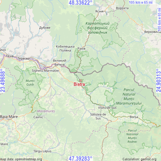
Bistra GPS coordinates[2]
47° 52' 0.012" North, 24° 12' 0" East
| Map corner | latitude | longitude |
|---|---|---|
| Upper-left | 48.33622°, | 23.49688° |
| Center: | 47.86667°, | 24.2° |
| Lower-right: | 47.39283°, | 24.90313° |
| Map W x H: | 104.9×104.9 km | = 65.2×65.2mi |
| max Lat: | 48.23793° ⇑2.5% North |
| Bistra: | 47.86667° |
| min Lat: | ⇓97.5% South 43.65638° |
| min Long | Bistra | max Long |
| 20.31667° | 24.2° | 29.65403° |
| W 34%⇐ | ⇒66% E |
Elevation
Elevation of Bistra is 383 m = 1257 ft, and this is 128.1 m = 420 ft above average elevation for this country.
| Max E: |
1278 m = 4193 ft | 21.1% |
| Bistra | 383 m 1257 ft | |
| Avg. | 254.9 m = 836 ft | |
Min E: |
-2 m = -7 ft | 78.9% |
See also: Romania elevation on elevation.city.
Geographical zone
Bistra is located in North temperate zone (between Tropic of Cancer and the Arctic Circle). Distance of this North polar circle is 2078.9 km =1291.8 mi to North.| Distance of | km | miles | from Bistra |
|---|---|---|---|
| North Pole | 4684.8 | 2911 | to North |
| Arctic Circle | 2078.9 | 1291.8 | to North |
| Tropic Cancer | 2716.4 | 1687.9 | to South |
| Equator | 5322.3 | 3307.1 | to South |


Nearby cities:
15 places around Bistra: (largest is in red/bold)
• Bârsana
11.4 km =7.1 mi,  240°
240°
• Coștiui
12.7 km =7.9 mi,  276°
276°
• Crasna Vișeului
4.8 km =3 mi,  152°
152°
• Leordina
10 km =6.2 mi,  158°
158°
• Lunca la Tisa
14.6 km =9.1 mi,  310°
310°
• Nănești
14.5 km =9 mi,  257°
257°
• Petrova
4.3 km =2.7 mi, 164°
• Repedea
15.4 km =9.6 mi,  103°
103°
• Rona de Jos
14.8 km =9.2 mi,  292°
292°
• Rona de Sus
11.8 km =7.3 mi, 288°
• Rozavlea
14.9 km =9.3 mi,  175°
175°
• Ruscova
10.4 km =6.5 mi,  142°
142°
• Slătioara
14.7 km =9.1 mi,  212°
212°
• Strâmtura
10.5 km =6.5 mi, 208°
• Valea Vișeului
5.9 km =3.7 mi,  328°
328°
Sources, notices
• [Note1] Compared only with cities in Romania existing in our database
• [Src1] Map data: © OpenStreetMap contributors (CC-BY-SA)
• [Src2] Other city data from geonames.org with taken over terms of usage.
• [Src3] Geographical zone / Annual Mean Temperature by Robert A. Rohde @ Wikipedia
