Batăr geodata
Batăr (Bihor) is a seat of a second-order administrative division; located in Romania in Europe/Bucharest (GMT+3) time zone. With population of 5,143 people, there are 732 cities with bigger population in this country. Compared to other cities in Romania, 71.7% of cities are located further ↓South; 95.7% of cities are located further →East and 78.4% of cities have higher elevation than Batăr. Note1


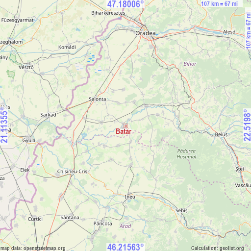
Batăr GPS coordinates[2]
46° 42' 0" North, 21° 49' 0.012" East
| Map corner | latitude | longitude |
|---|---|---|
| Upper-left | 47.18006°, | 21.11355° |
| Center: | 46.7°, | 21.81667° |
| Lower-right: | 46.21563°, | 22.5198° |
| Map W x H: | 107.2×107.2 km | = 66.6×66.6mi |
| max Lat: | 48.23793° ⇑28.3% North |
| Batăr: | 46.7° |
| min Lat: | ⇓71.7% South 43.65638° |
| min Long | Batăr | max Long |
| 20.31667° | 21.81667° | 29.65403° |
| W 4.3%⇐ | ⇒95.7% E |
Elevation
Elevation of Batăr is 100 m = 328 ft, and this is 154.9 m = 508 ft below average elevation for this country.
| Max E: |
1278 m = 4193 ft | 78.4% |
| Avg. | 254.9 m = 836 ft | |
| Batăr | 100 m = 328 ft | |
Min E: |
-2 m = -7 ft | 21.6% |
See also: Romania elevation on elevation.city.
Geographical zone
Batăr is located in North temperate zone (between Tropic of Cancer and the Arctic Circle). Distance of this North polar circle is 2208.6 km =1372.4 mi to North.| Distance of | km | miles | from Batăr |
|---|---|---|---|
| North Pole | 4814.5 | 2991.6 | to North |
| Arctic Circle | 2208.6 | 1372.4 | to North |
| Tropic Cancer | 2586.6 | 1607.2 | to South |
| Equator | 5192.6 | 3226.5 | to South |


Nearby cities:
15 places around Batăr: (largest is in red/bold)
• Apateu
9.6 km =6 mi,  195°
195°
• Arpășel
8.6 km =5.3 mi,  300°
300°
• Belfir
11 km =6.8 mi,  67°
67°
• Berechiu
7.1 km =4.4 mi,  161°
161°
• Călacea
9.2 km =5.7 mi,  106°
106°
• Căuașd
10.1 km =6.3 mi,  1°
1°
• Ghiorac
10.3 km =6.4 mi,  278°
278°
• Gurbediu
11.1 km =6.9 mi,  19°
19°
• Olcea
12.8 km =8 mi,  98°
98°
• Satu Nou
12.2 km =7.6 mi,  225°
225°
• Susag
12.5 km =7.8 mi,  142°
142°
• Talpoș
1.4 km =0.9 mi, 226°
• Tinca
12.2 km =7.6 mi,  46°
46°
• Tulca
9.6 km =6 mi,  344°
344°
• Tăut
2.8 km =1.7 mi,  36°
36°
Sources, notices
• [Note1] Compared only with cities in Romania existing in our database
• [Src1] Map data: © OpenStreetMap contributors (CC-BY-SA)
• [Src2] Other city data from geonames.org with taken over terms of usage.
• [Src3] Geographical zone / Annual Mean Temperature by Robert A. Rohde @ Wikipedia
