Gurbediu geodata
Gurbediu (Bihor) is a populated place; located in Romania in Europe/Bucharest (GMT+3) time zone. With population of 1,245 people, there are 3647 cities with bigger population in this country. Compared to other cities in Romania, 73.9% of cities are located further ↓South; 95.3% of cities are located further →East and 72.7% of cities have higher elevation than Gurbediu. Note1


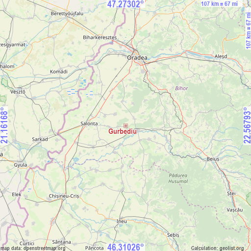
Gurbediu GPS coordinates[2]
46° 47' 37.644" North, 21° 51' 53.28" East
| Map corner | latitude | longitude |
|---|---|---|
| Upper-left | 47.27302°, | 21.16168° |
| Center: | 46.79379°, | 21.8648° |
| Lower-right: | 46.31026°, | 22.56793° |
| Map W x H: | 107×107 km | = 66.5×66.5mi |
| max Lat: | 48.23793° ⇑26.1% North |
| Gurbediu: | 46.79379° |
| min Lat: | ⇓73.9% South 43.65638° |
| min Long | Gurbediu | max Long |
| 20.31667° | 21.8648° | 29.65403° |
| W 4.7%⇐ | ⇒95.3% E |
Elevation
Elevation of Gurbediu is 118 m = 387 ft, and this is 136.9 m = 449 ft below average elevation for this country.
| Max E: |
1278 m = 4193 ft | 72.7% |
| Avg. | 254.9 m = 836 ft | |
| Gurbediu | 118 m = 387 ft | |
Min E: |
-2 m = -7 ft | 27.3% |
See also: Romania elevation on elevation.city.
Geographical zone
Gurbediu is located in North temperate zone (between Tropic of Cancer and the Arctic Circle). Distance of this North polar circle is 2198.2 km =1365.9 mi to North.| Distance of | km | miles | from Gurbediu |
|---|---|---|---|
| North Pole | 4804.1 | 2985.1 | to North |
| Arctic Circle | 2198.2 | 1365.9 | to North |
| Tropic Cancer | 2597.1 | 1613.8 | to South |
| Equator | 5203 | 3233 | to South |


Nearby cities:
15 places around Gurbediu: (largest is in red/bold)
• Arpășel
12.6 km =7.8 mi,  240°
240°
• Batăr
11.1 km =6.9 mi,  199°
199°
• Belfir
9 km =5.6 mi,  134°
134°
• Cociuba Mare
12.3 km =7.6 mi,  123°
123°
• Căuașd
3.4 km =2.1 mi,  264°
264°
• Gepiș
13.2 km =8.2 mi,  63°
63°
• Homorog
9.9 km =6.2 mi,  294°
294°
• Husasău de Tinca
4.7 km =2.9 mi, 57°
• Ianoșda
6.5 km =4 mi,  318°
318°
• Râpa
12.2 km =7.6 mi,  95°
95°
• Sititelec
9.7 km =6 mi,  17°
17°
• Talpoș
12.3 km =7.6 mi, 202°
• Tinca
5.6 km =3.5 mi,  111°
111°
• Tulca
6.3 km =3.9 mi, 259°
• Tăut
8.5 km =5.3 mi,  193°
193°
Sources, notices
• [Note1] Compared only with cities in Romania existing in our database
• [Src1] Map data: © OpenStreetMap contributors (CC-BY-SA)
• [Src2] Other city data from geonames.org with taken over terms of usage.
• [Src3] Geographical zone / Annual Mean Temperature by Robert A. Rohde @ Wikipedia
