Băileşti geodata
Băileşti (Dolj) is a seat of a second-order administrative division; located in Romania in Europe/Bucharest (GMT+3) time zone. With population of 19,599 people, there are 109 cities with bigger population in this country. Compared to other cities in Romania, 96.7% of cities are located further ↑North; 79.3% of cities are located further →East and 90.7% of cities have higher elevation than Băileşti. Note1


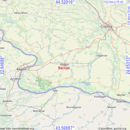
Băileşti GPS coordinates[2]
44° 1' 0.012" North, 23° 21' 0" East
| Map corner | latitude | longitude |
|---|---|---|
| Upper-left | 44.52016°, | 22.64688° |
| Center: | 44.01667°, | 23.35° |
| Lower-right: | 43.50887°, | 24.05313° |
| Map W x H: | 112.4×112.4 km | = 69.8×69.8mi |
| max Lat: | 48.23793° ⇑96.7% North |
| Băileşti: | 44.01667° |
| min Lat: | ⇓3.3% South 43.65638° |
| min Long | Băileşti | max Long |
| 20.31667° | 23.35° | 29.65403° |
| W 20.7%⇐ | ⇒79.3% E |
Elevation
Elevation of Băileşti is 55 m = 180 ft, and this is 199.9 m = 656 ft below average elevation for this country.
| Max E: |
1278 m = 4193 ft | 90.7% |
| Avg. | 254.9 m = 836 ft | |
| Băileşti | 55 m = 180 ft | |
Min E: |
-2 m = -7 ft | 9.3% |
See also: Romania elevation on elevation.city.
Geographical zone
Băileşti is located in North temperate zone (between Tropic of Cancer and the Arctic Circle). Distance of this Northern Tropic circle is 2288.3 km =1421.9 mi to South.| Distance of | km | miles | from Băileşti |
|---|---|---|---|
| North Pole | 5112.9 | 3177 | to North |
| Arctic Circle | 2507 | 1557.8 | to North |
| Tropic Cancer | 2288.3 | 1421.9 | to South |
| Equator | 4894.2 | 3041.1 | to South |


Nearby cities:
15 places around Băileşti: (largest is in red/bold)
• Afumaţi
9.5 km =5.9 mi,  101°
101°
• Boureni
6.7 km =4.2 mi,  90°
90°
• Catane
11.2 km =7 mi,  153°
153°
• Cioroiași
10.9 km =6.8 mi,  47°
47°
• Cioroiu Nou
8.5 km =5.3 mi, 52°
• Covei
7.5 km =4.7 mi,  129°
129°
• Domnu Tudor
13.9 km =8.6 mi,  349°
349°
• Galicea Mare
10.1 km =6.3 mi,  336°
336°
• Galiciuica
10.2 km =6.3 mi,  18°
18°
• Giubega
13.1 km =8.1 mi, 20°
• Moţăţei
14.1 km =8.8 mi,  301°
301°
• Moțăței Gară
12.8 km =8 mi,  281°
281°
• Negoi
11.6 km =7.2 mi,  170°
170°
• Seaca de Câmp
14.1 km =8.8 mi,  229°
229°
• Siliştea Crucii
10.8 km =6.7 mi,  80°
80°
Sources, notices
• [Note1] Compared only with cities in Romania existing in our database
• [Src1] Map data: © OpenStreetMap contributors (CC-BY-SA)
• [Src2] Other city data from geonames.org with taken over terms of usage.
• [Src3] Geographical zone / Annual Mean Temperature by Robert A. Rohde @ Wikipedia
