Afumaţi geodata
Afumaţi (Dolj) is a seat of a second-order administrative division; located in Romania in Europe/Bucharest (GMT+3) time zone. With population of 3,247 people, there are 1589 cities with bigger population in this country. Compared to other cities in Romania, 97% of cities are located further ↑North; 77.6% of cities are located further →East and 91.3% of cities have higher elevation than Afumaţi. Note1


Afumaţi GPS coordinates[2]
44° 0' 0" North, 23° 28' 0.012" East
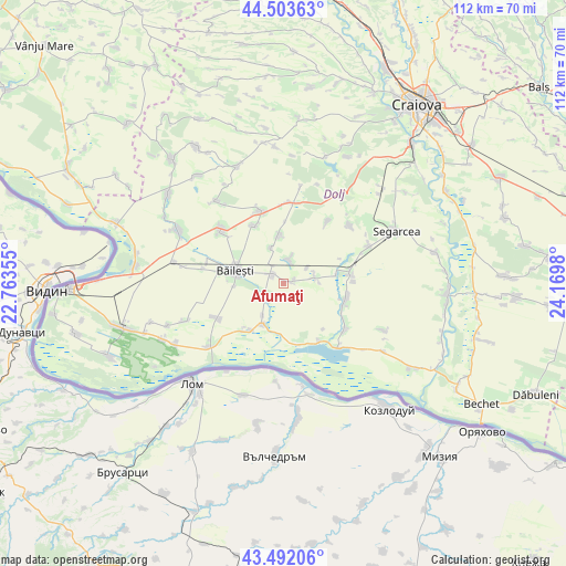
| Map corner | latitude | longitude |
|---|---|---|
| Upper-left | 44.50363°, | 22.76355° |
| Center: | 44°, | 23.46667° |
| Lower-right: | 43.49206°, | 24.1698° |
| Map W x H: | 112.5×112.5 km | = 69.9×69.9mi |
| max Lat: | 48.23793° ⇑97% North |
| Afumaţi: | 44° |
| min Lat: | ⇓3% South 43.65638° |
| min Long | Afumaţi | max Long |
| 20.31667° | 23.46667° | 29.65403° |
| W 22.4%⇐ | ⇒77.6% E |
Elevation
Elevation of Afumaţi is 52 m = 171 ft, and this is 202.9 m = 666 ft below average elevation for this country.
| Max E: |
1278 m = 4193 ft | 91.3% |
| Avg. | 254.9 m = 836 ft | |
| Afumaţi | 52 m = 171 ft | |
Min E: |
-2 m = -7 ft | 8.7% |
See also: Romania elevation on elevation.city.
Geographical zone
Afumaţi is located in North temperate zone (between Tropic of Cancer and the Arctic Circle). Distance of this Northern Tropic circle is 2286.4 km =1420.7 mi to South.| Distance of | km | miles | from Afumaţi |
|---|---|---|---|
| North Pole | 5114.7 | 3178.1 | to North |
| Arctic Circle | 2508.8 | 1558.9 | to North |
| Tropic Cancer | 2286.4 | 1420.7 | to South |
| Equator | 4892.3 | 3039.9 | to South |


Nearby cities:
15 places around Afumaţi: (largest is in red/bold)
• Bistreț
11.4 km =7.1 mi,  166°
166°
• Bistrețu Nou
11 km =6.8 mi,  177°
177°
• Boureni
3.2 km =2 mi,  304°
304°
• Bârca
12.6 km =7.8 mi,  107°
107°
• Băileşti
9.5 km =5.9 mi,  281°
281°
• Catane
9.3 km =5.8 mi,  208°
208°
• Cioroiași
9.4 km =5.8 mi,  351°
351°
• Cioroiu Nou
7.5 km =4.7 mi,  339°
339°
• Covei
4.6 km =2.9 mi,  230°
230°
• Galiciuica
13 km =8.1 mi,  332°
332°
• Giurgiţa
13.5 km =8.4 mi,  82°
82°
• Negoi
12.2 km =7.6 mi,  218°
218°
• Siliştea Crucii
3.9 km =2.4 mi,  19°
19°
• Urzica Mare
10.6 km =6.6 mi, 80°
• Urzicuţa
6.9 km =4.3 mi,  74°
74°
Sources, notices
• [Note1] Compared only with cities in Romania existing in our database
• [Src1] Map data: © OpenStreetMap contributors (CC-BY-SA)
• [Src2] Other city data from geonames.org with taken over terms of usage.
• [Src3] Geographical zone / Annual Mean Temperature by Robert A. Rohde @ Wikipedia
