Albac geodata
Albac (Alba) is a seat of a second-order administrative division; located in Romania in Europe/Bucharest (GMT+3) time zone. With population of 2,168 people, there are 2455 cities with bigger population in this country. Compared to other cities in Romania, 66% of cities are located further ↓South; 85.1% of cities are located further →East and 94.9% of cities have lower elevation than Albac. Note1


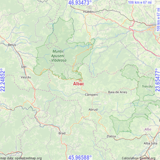
Albac GPS coordinates[2]
46° 27' 8.856" North, 22° 57' 5.904" East
| Map corner | latitude | longitude |
|---|---|---|
| Upper-left | 46.93473°, | 22.24852° |
| Center: | 46.45246°, | 22.95164° |
| Lower-right: | 45.96588°, | 23.65477° |
| Map W x H: | 107.7×107.7 km | = 66.9×66.9mi |
| max Lat: | 48.23793° ⇑34% North |
| Albac: | 46.45246° |
| min Lat: | ⇓66% South 43.65638° |
| min Long | Albac | max Long |
| 20.31667° | 22.95164° | 29.65403° |
| W 14.9%⇐ | ⇒85.1% E |
Elevation
Elevation of Albac is 626 m = 2054 ft, and this is 371.1 m = 1218 ft above average elevation for this country.
| Max E: |
1278 m = 4193 ft | 5.1% |
| Albac | 626 m 2054 ft | |
| Avg. | 254.9 m = 836 ft | |
Min E: |
-2 m = -7 ft | 94.9% |
See also: Romania elevation on elevation.city.
Geographical zone
Albac is located in North temperate zone (between Tropic of Cancer and the Arctic Circle). Distance of this North polar circle is 2236.1 km =1389.4 mi to North.| Distance of | km | miles | from Albac |
|---|---|---|---|
| North Pole | 4842 | 3008.7 | to North |
| Arctic Circle | 2236.1 | 1389.4 | to North |
| Tropic Cancer | 2559.1 | 1590.2 | to South |
| Equator | 5165 | 3209.4 | to South |


Nearby cities:
15 places around Albac: (largest is in red/bold)
• Abrud-Sat
20.8 km =12.9 mi,  156°
156°
• Arieşeni
15.1 km =9.4 mi,  280°
280°
• Avram Iancu
15 km =9.3 mi,  239°
239°
• Bistra
14.1 km =8.8 mi,  125°
125°
• Câmpeni
12.2 km =7.6 mi,  141°
141°
• Dăroaia
18.1 km =11.2 mi, 155°
• Gârda de Sus
10.3 km =6.4 mi,  268°
268°
• Horea
5.6 km =3.5 mi,  358°
358°
• Lupşa
21.3 km =13.2 mi,  116°
116°
• Mușca
19.9 km =12.4 mi, 122°
• Poiana Vadului
7.8 km =4.8 mi,  221°
221°
• Scărişoara
7.9 km =4.9 mi, 281°
• Sohodol
12.3 km =7.6 mi,  151°
151°
• Vadu Moţilor
5.9 km =3.7 mi,  168°
168°
• Vidra
10.6 km =6.6 mi,  207°
207°
Sources, notices
• [Note1] Compared only with cities in Romania existing in our database
• [Src1] Map data: © OpenStreetMap contributors (CC-BY-SA)
• [Src2] Other city data from geonames.org with taken over terms of usage.
• [Src3] Geographical zone / Annual Mean Temperature by Robert A. Rohde @ Wikipedia
