Višnjićevo geodata
Višnjićevo (Vojvodina) is a populated place; located in Serbia in Europe/Belgrade (GMT+2) time zone. With population of 2,030 people, there are 212 cities with bigger population in this country. Compared to other cities in Serbia, 56.2% of cities are located further ↓South; 95.5% of cities are located further →East and 67.1% of cities have higher elevation than Višnjićevo. Note1


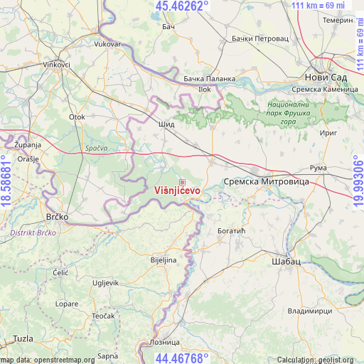
Višnjićevo GPS coordinates[2]
44° 58' 2.316" North, 19° 17' 23.748" East
| Map corner | latitude | longitude |
|---|---|---|
| Upper-left | 45.46262°, | 18.58681° |
| Center: | 44.96731°, | 19.28993° |
| Lower-right: | 44.46768°, | 19.99306° |
| Map W x H: | 110.6×110.6 km | = 68.7×68.7mi |
| max Lat: | 46.1° ⇑43.8% North |
| Višnjićevo: | 44.96731° |
| min Lat: | ⇓56.2% South 42.25846° |
| min Long | Višnjićevo | max Long |
| 18.9276° | 19.28993° | 22.77556° |
| W 4.5%⇐ | ⇒95.5% E |
Elevation
Elevation of Višnjićevo is 80 m = 262 ft, and this is 96.4 m = 316 ft below average elevation for this country.
| Max E: |
1421 m = 4662 ft | 67.1% |
| Avg. | 176.4 m = 579 ft | |
| Višnjićevo | 80 m = 262 ft | |
Min E: |
49 m = 161 ft | 32.9% |
See also: Serbia elevation on elevation.city.
Geographical zone
Višnjićevo is located in North temperate zone (between Tropic of Cancer and the Arctic Circle). Distance of this Northern Tropic circle is 2394 km =1487.6 mi to South.| Distance of | km | miles | from Višnjićevo |
|---|---|---|---|
| North Pole | 5007.2 | 3111.3 | to North |
| Arctic Circle | 2401.3 | 1492.1 | to North |
| Tropic Cancer | 2394 | 1487.6 | to South |
| Equator | 4999.9 | 3106.8 | to South |


Nearby cities:
15 places around Višnjićevo: (largest is in red/bold)
• Badovinci
21.2 km =13.2 mi,  162°
162°
• Banovo Polje
14 km =8.7 mi,  116°
116°
• Bogatić
20.8 km =12.9 mi,  133°
133°
• Bosut
7 km =4.3 mi, 126°
• Crna Bara
13.3 km =8.3 mi,  141°
141°
• Glogovac
15.2 km =9.4 mi, 139°
• Glušci
22.1 km =13.7 mi,  112°
112°
• Klenje
21.1 km =13.1 mi,  147°
147°
• Radenković
16.9 km =10.5 mi, 107°
• Ravnje
10.8 km =6.7 mi,  104°
104°
• Salaš Crnobarski
17.5 km =10.9 mi, 151°
• Salaš Noćajski
23.4 km =14.5 mi, 95°
• Sremska Rača
5.2 km =3.2 mi,  183°
183°
• Zasavica Prva
15.8 km =9.8 mi, 95°
• Šid
18.6 km =11.6 mi,  344°
344°
Sources, notices
• [Note1] Compared only with cities in Serbia existing in our database
• [Src1] Map data: © OpenStreetMap contributors (CC-BY-SA)
• [Src2] Other city data from geonames.org with taken over terms of usage.
• [Src3] Geographical zone / Annual Mean Temperature by Robert A. Rohde @ Wikipedia
