Buđanovci geodata
Buđanovci (Vojvodina) is a populated place; located in Serbia in Europe/Belgrade (GMT+2) time zone. With population of 1,999 people, there are 216 cities with bigger population in this country. Compared to other cities in Serbia, 52.8% of cities are located further ↓South; 70.5% of cities are located further →East and 78.9% of cities have higher elevation than Buđanovci. Note1


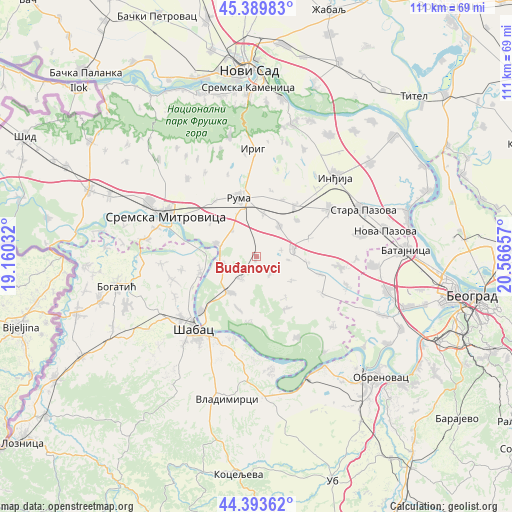
Buđanovci GPS coordinates[2]
44° 53' 37.968" North, 19° 51' 48.384" East
| Map corner | latitude | longitude |
|---|---|---|
| Upper-left | 45.38983°, | 19.16032° |
| Center: | 44.89388°, | 19.86344° |
| Lower-right: | 44.39362°, | 20.56657° |
| Map W x H: | 110.8×110.8 km | = 68.8×68.8mi |
| max Lat: | 46.1° ⇑47.2% North |
| Buđanovci: | 44.89388° |
| min Lat: | ⇓52.8% South 42.25846° |
| min Long | Buđanovci | max Long |
| 18.9276° | 19.86344° | 22.77556° |
| W 29.5%⇐ | ⇒70.5% E |
Elevation
Elevation of Buđanovci is 78 m = 256 ft, and this is 98.4 m = 323 ft below average elevation for this country.
| Max E: |
1421 m = 4662 ft | 78.9% |
| Avg. | 176.4 m = 579 ft | |
| Buđanovci | 78 m = 256 ft | |
Min E: |
49 m = 161 ft | 21.1% |
See also: Serbia elevation on elevation.city.
Geographical zone
Buđanovci is located in North temperate zone (between Tropic of Cancer and the Arctic Circle). Distance of this Northern Tropic circle is 2385.8 km =1482.5 mi to South.| Distance of | km | miles | from Buđanovci |
|---|---|---|---|
| North Pole | 5015.3 | 3116.4 | to North |
| Arctic Circle | 2409.4 | 1497.1 | to North |
| Tropic Cancer | 2385.8 | 1482.5 | to South |
| Equator | 4991.7 | 3101.7 | to South |


Nearby cities:
15 places around Buđanovci: (largest is in red/bold)
• Drenovac
12.5 km =7.8 mi,  255°
255°
• Golubinci
18.7 km =11.6 mi,  57°
57°
• Grabovci
14.4 km =8.9 mi,  185°
185°
• Hrtkovci
8 km =5 mi, 260°
• Irig
17.7 km =11 mi,  355°
355°
• Jarak
9 km =5.6 mi,  287°
287°
• Klenak
16.8 km =10.4 mi,  225°
225°
• Nikinci
5.8 km =3.6 mi,  213°
213°
• Pećinci
8.3 km =5.2 mi,  78°
78°
• Platičevo
9.6 km =6 mi, 214°
• Putinci
13.9 km =8.6 mi,  37°
37°
• Ruma
13.1 km =8.1 mi,  345°
345°
• Šašinci
12.4 km =7.7 mi,  309°
309°
• Ševarice
16.3 km =10.1 mi, 259°
• Šimanovci
18.1 km =11.2 mi,  97°
97°
Sources, notices
• [Note1] Compared only with cities in Serbia existing in our database
• [Src1] Map data: © OpenStreetMap contributors (CC-BY-SA)
• [Src2] Other city data from geonames.org with taken over terms of usage.
• [Src3] Geographical zone / Annual Mean Temperature by Robert A. Rohde @ Wikipedia
