Pirot geodata
Pirot (Central Serbia) is a seat of a second-order administrative division; located in Serbia in Europe/Belgrade (GMT+2) time zone. With population of 40,678 people, there are 23 cities with bigger population in this country. Compared to other cities in Serbia, 91.8% of cities are located further ↑North; 99.5% of cities are located further ←West and 88.9% of cities have lower elevation than Pirot. Note1


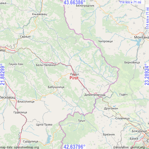
Pirot GPS coordinates[2]
43° 9' 11.016" North, 22° 35' 9.996" East
| Map corner | latitude | longitude |
|---|---|---|
| Upper-left | 43.66386°, | 21.88299° |
| Center: | 43.15306°, | 22.58611° |
| Lower-right: | 42.63796°, | 23.28924° |
| Map W x H: | 114.1×114.1 km | = 70.9×70.9mi |
| max Lat: | 46.1° ⇑91.8% North |
| Pirot: | 43.15306° |
| min Lat: | ⇓8.2% South 42.25846° |
| min Long | Pirot | max Long |
| 18.9276° | 22.58611° | 22.77556° |
| W 99.5%⇐ | ⇒0.5% E |
Elevation
Elevation of Pirot is 371 m = 1217 ft, and this is 194.6 m = 638 ft above average elevation for this country.
| Max E: |
1421 m = 4662 ft | 11.1% |
| Pirot | 371 m 1217 ft | |
| Avg. | 176.4 m = 579 ft | |
Min E: |
49 m = 161 ft | 88.9% |
See also: Pirot elevation on elevation.city.
Geographical zone
Pirot is located in North temperate zone (between Tropic of Cancer and the Arctic Circle). Distance of this Northern Tropic circle is 2192.3 km =1362.2 mi to South.| Distance of | km | miles | from Pirot |
|---|---|---|---|
| North Pole | 5208.9 | 3236.7 | to North |
| Arctic Circle | 2603 | 1617.4 | to North |
| Tropic Cancer | 2192.3 | 1362.2 | to South |
| Equator | 4798.2 | 2981.5 | to South |


Nearby cities:
15 places around Pirot: (largest is in red/bold)
• Bela Palanka
23.4 km =14.5 mi,  288°
288°
• Brezovica
39.9 km =24.8 mi,  236°
236°
• Crna Trava
44.7 km =27.8 mi,  211°
211°
• Dimitrovgrad
21.8 km =13.5 mi,  135°
135°
• Dolac naselje
34.6 km =21.5 mi,  297°
297°
• Doljevac
61.3 km =38.1 mi,  274°
274°
• Gadžin Han
45.6 km =28.3 mi,  279°
279°
• Knjazevac
53.1 km =33 mi,  329°
329°
• Leskovac
54.8 km =34.1 mi,  251°
251°
• Niš
58.5 km =36.4 mi, 289°
• Niška Banja
49.6 km =30.8 mi, 288°
• Surdulica
61.5 km =38.2 mi, 213°
• Svrljig
47.5 km =29.5 mi,  307°
307°
• Vladičin Han
65.3 km =40.6 mi,  220°
220°
• Vlasotince
42.2 km =26.2 mi, 240°
Sources, notices
• [Note1] Compared only with cities in Serbia existing in our database
• [Src1] Map data: © OpenStreetMap contributors (CC-BY-SA)
• [Src2] Other city data from geonames.org with taken over terms of usage.
• [Src3] Geographical zone / Annual Mean Temperature by Robert A. Rohde @ Wikipedia
