Niš geodata
Niš (Central Serbia) is a seat of a second-order administrative division; located in Serbia in Europe/Belgrade (GMT+2) time zone. With population of 250,000 people, there is 1 city with bigger population in this country. Compared to other cities in Serbia, 87.8% of cities are located further ↑North; 94.1% of cities are located further ←West and 75.3% of cities have lower elevation than Niš. Note1


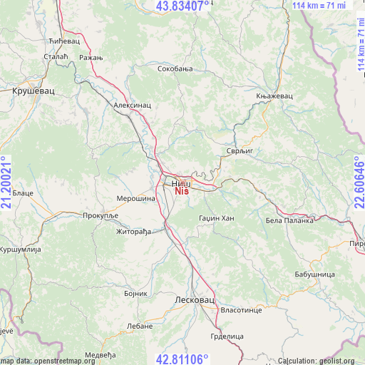
Niš GPS coordinates[2]
43° 19' 28.992" North, 21° 54' 11.988" East
| Map corner | latitude | longitude |
|---|---|---|
| Upper-left | 43.83407°, | 21.20021° |
| Center: | 43.32472°, | 21.90333° |
| Lower-right: | 42.81106°, | 22.60646° |
| Map W x H: | 113.7×113.7 km | = 70.6×70.6mi |
| max Lat: | 46.1° ⇑87.8% North |
| Niš: | 43.32472° |
| min Lat: | ⇓12.2% South 42.25846° |
| min Long | Niš | max Long |
| 18.9276° | 21.90333° | 22.77556° |
| W 94.1%⇐ | ⇒5.9% E |
Elevation
Elevation of Niš is 194 m = 636 ft, and this is 17.6 m = 58 ft above average elevation for this country.
| Max E: |
1421 m = 4662 ft | 24.7% |
| Niš | 194 m 636 ft | |
| Avg. | 176.4 m = 579 ft | |
Min E: |
49 m = 161 ft | 75.3% |
See also: Niš elevation on elevation.city.
Geographical zone
Niš is located in North temperate zone (between Tropic of Cancer and the Arctic Circle). Distance of this Northern Tropic circle is 2211.3 km =1374 mi to South.| Distance of | km | miles | from Niš |
|---|---|---|---|
| North Pole | 5189.8 | 3224.8 | to North |
| Arctic Circle | 2583.9 | 1605.6 | to North |
| Tropic Cancer | 2211.3 | 1374 | to South |
| Equator | 4817.3 | 2993.3 | to South |


Nearby cities:
15 places around Niš: (largest is in red/bold)
• Aleksinac
28.8 km =17.9 mi,  326°
326°
• Bela Palanka
35.1 km =21.8 mi,  109°
109°
• Bojnik
37.8 km =23.5 mi,  203°
203°
• Dolac naselje
24.7 km =15.3 mi,  97°
97°
• Doljevac
15.2 km =9.4 mi, 202°
• Gadžin Han
15.4 km =9.6 mi,  137°
137°
• Knjazevac
39.2 km =24.4 mi,  46°
46°
• Leskovac
36.5 km =22.7 mi,  174°
174°
• Merošina
15.5 km =9.6 mi,  252°
252°
• Niška Banja
8.9 km =5.5 mi, 111°
• Prokuplje
27.4 km =17 mi, 248°
• Soko Banja
35.5 km =22.1 mi,  355°
355°
• Svrljig
20.2 km =12.6 mi,  60°
60°
• Žitni Potok
37.3 km =23.2 mi,  225°
225°
• Žitorađa
21.5 km =13.4 mi, 225°
Sources, notices
• [Note1] Compared only with cities in Serbia existing in our database
• [Src1] Map data: © OpenStreetMap contributors (CC-BY-SA)
• [Src2] Other city data from geonames.org with taken over terms of usage.
• [Src3] Geographical zone / Annual Mean Temperature by Robert A. Rohde @ Wikipedia
