Idvor geodata
Idvor (Vojvodina) is a populated place; located in Serbia in Europe/Belgrade (GMT+2) time zone. With population of 1,442 people, there are 270 cities with bigger population in this country. Compared to other cities in Serbia, 68.7% of cities are located further ↓South; 59.4% of cities are located further ←West and 90.7% of cities have higher elevation than Idvor. Note1


Idvor GPS coordinates[2]
45° 11' 20.22" North, 20° 30' 51.912" East
| Map corner | latitude | longitude |
|---|---|---|
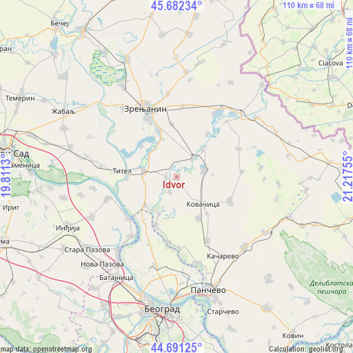
| Upper-left | 45.68234°, | 19.8113° |
| Center: | 45.18895°, | 20.51442° |
| Lower-right: | 44.69125°, | 21.21755° |
| Map W x H: | 110.2×110.2 km | = 68.5×68.5mi |
| max Lat: | 46.1° ⇑31.3% North |
| Idvor: | 45.18895° |
| min Lat: | ⇓68.7% South 42.25846° |
| min Long | Idvor | max Long |
| 18.9276° | 20.51442° | 22.77556° |
| W 59.4%⇐ | ⇒40.6% E |
Elevation
Elevation of Idvor is 76 m = 249 ft, and this is 100.4 m = 329 ft below average elevation for this country.
| Max E: |
1421 m = 4662 ft | 90.7% |
| Avg. | 176.4 m = 579 ft | |
| Idvor | 76 m = 249 ft | |
Min E: |
49 m = 161 ft | 9.3% |
See also: Serbia elevation on elevation.city.
Geographical zone
Idvor is located in North temperate zone (between Tropic of Cancer and the Arctic Circle). Distance of this North polar circle is 2376.6 km =1476.8 mi to North.| Distance of | km | miles | from Idvor |
|---|---|---|---|
| North Pole | 4982.5 | 3096 | to North |
| Arctic Circle | 2376.6 | 1476.8 | to North |
| Tropic Cancer | 2418.6 | 1502.8 | to South |
| Equator | 5024.5 | 3122.1 | to South |


Nearby cities:
15 places around Idvor: (largest is in red/bold)
• Baranda
12.9 km =8 mi,  205°
205°
• Belo Blato
14.4 km =8.9 mi,  310°
310°
• Debeljača
14.8 km =9.2 mi,  152°
152°
• Ečka
15.9 km =9.9 mi,  339°
339°
• Farkaždin
3.3 km =2.1 mi,  275°
275°
• Knićanin
15.3 km =9.5 mi,  269°
269°
• Kovačica
12 km =7.5 mi,  135°
135°
• Lukino Selo
14.4 km =8.9 mi,  331°
331°
• Orlovat
7.8 km =4.8 mi,  41°
41°
• Perlez
10.6 km =6.6 mi, 281°
• Sakule
5.2 km =3.2 mi, 205°
• Stajićevo
12.6 km =7.8 mi, 339°
• Tomaševac
12.3 km =7.6 mi, 43°
• Uzdin
8.7 km =5.4 mi,  78°
78°
• Čenta
13.3 km =8.3 mi,  227°
227°
Sources, notices
• [Note1] Compared only with cities in Serbia existing in our database
• [Src1] Map data: © OpenStreetMap contributors (CC-BY-SA)
• [Src2] Other city data from geonames.org with taken over terms of usage.
• [Src3] Geographical zone / Annual Mean Temperature by Robert A. Rohde @ Wikipedia
