Ðurđevo geodata
Ðurđevo (Vojvodina) is a populated place; located in Serbia in Europe/Belgrade (GMT+2) time zone. With population of 4,668 people, there are 100 cities with bigger population in this country. Compared to other cities in Serbia, 78.2% of cities are located further ↓South; 65.8% of cities are located further →East and 67.1% of cities have higher elevation than Ðurđevo. Note1


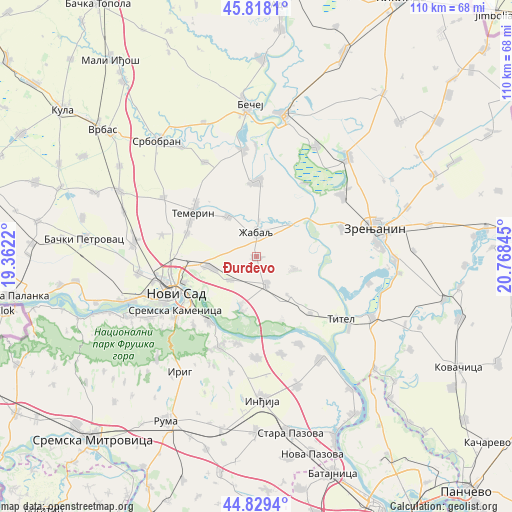
Ðurđevo GPS coordinates[2]
45° 19' 33.276" North, 20° 3' 55.152" East
| Map corner | latitude | longitude |
|---|---|---|
| Upper-left | 45.8181°, | 19.3622° |
| Center: | 45.32591°, | 20.06532° |
| Lower-right: | 44.8294°, | 20.76845° |
| Map W x H: | 109.9×109.9 km | = 68.3×68.3mi |
| max Lat: | 46.1° ⇑21.8% North |
| Ðurđevo: | 45.32591° |
| min Lat: | ⇓78.2% South 42.25846° |
| min Long | Ðurđevo | max Long |
| 18.9276° | 20.06532° | 22.77556° |
| W 34.2%⇐ | ⇒65.8% E |
Elevation
Elevation of Ðurđevo is 80 m = 262 ft, and this is 96.4 m = 316 ft below average elevation for this country.
| Max E: |
1421 m = 4662 ft | 67.1% |
| Avg. | 176.4 m = 579 ft | |
| Ðurđevo | 80 m = 262 ft | |
Min E: |
49 m = 161 ft | 32.9% |
See also: Serbia elevation on elevation.city.
Geographical zone
Ðurđevo is located in North temperate zone (between Tropic of Cancer and the Arctic Circle). Distance of this North polar circle is 2361.4 km =1467.3 mi to North.| Distance of | km | miles | from Ðurđevo |
|---|---|---|---|
| North Pole | 4967.3 | 3086.5 | to North |
| Arctic Circle | 2361.4 | 1467.3 | to North |
| Tropic Cancer | 2433.8 | 1512.3 | to South |
| Equator | 5039.8 | 3131.6 | to South |


Nearby cities:
15 places around Ðurđevo: (largest is in red/bold)
• Aradac
19.5 km =12.1 mi,  70°
70°
• Gardinovci
14.7 km =9.1 mi,  157°
157°
• Kovilj
10.7 km =6.6 mi,  197°
197°
• Lok
16.8 km =10.4 mi,  136°
136°
• Mošorin
8.5 km =5.3 mi,  108°
108°
• Novi Sad
19.7 km =12.2 mi,  245°
245°
• Petrovaradin
17 km =10.6 mi,  238°
238°
• Sremski Karlovci
17.1 km =10.6 mi,  216°
216°
• Taraš
18.9 km =11.7 mi,  33°
33°
• Temerin
16.5 km =10.3 mi,  303°
303°
• Vilovo
11.1 km =6.9 mi, 140°
• Čortanovci
19.4 km =12.1 mi,  190°
190°
• Čurug
16.3 km =10.1 mi,  0°
0°
• Šajkaš
6.2 km =3.9 mi, 161°
• Žabalj
5.2 km =3.2 mi,  358°
358°
Sources, notices
• [Note1] Compared only with cities in Serbia existing in our database
• [Src1] Map data: © OpenStreetMap contributors (CC-BY-SA)
• [Src2] Other city data from geonames.org with taken over terms of usage.
• [Src3] Geographical zone / Annual Mean Temperature by Robert A. Rohde @ Wikipedia
