Šajkaš geodata
Šajkaš (Vojvodina) is a populated place; located in Serbia in Europe/Belgrade (GMT+2) time zone. With population of 3,541 people, there are 126 cities with bigger population in this country. Compared to other cities in Serbia, 75.1% of cities are located further ↓South; 63.7% of cities are located further →East and 78.9% of cities have higher elevation than Šajkaš. Note1


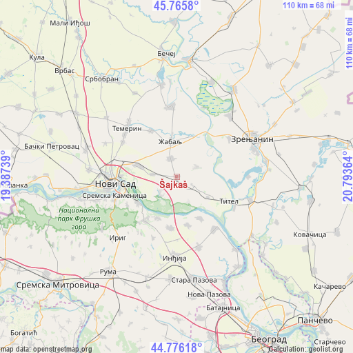
Šajkaš GPS coordinates[2]
45° 16' 23.34" North, 20° 5' 25.836" East
| Map corner | latitude | longitude |
|---|---|---|
| Upper-left | 45.7658°, | 19.38739° |
| Center: | 45.27315°, | 20.09051° |
| Lower-right: | 44.77618°, | 20.79364° |
| Map W x H: | 110×110 km | = 68.4×68.4mi |
| max Lat: | 46.1° ⇑24.9% North |
| Šajkaš: | 45.27315° |
| min Lat: | ⇓75.1% South 42.25846° |
| min Long | Šajkaš | max Long |
| 18.9276° | 20.09051° | 22.77556° |
| W 36.3%⇐ | ⇒63.7% E |
Elevation
Elevation of Šajkaš is 78 m = 256 ft, and this is 98.4 m = 323 ft below average elevation for this country.
| Max E: |
1421 m = 4662 ft | 78.9% |
| Avg. | 176.4 m = 579 ft | |
| Šajkaš | 78 m = 256 ft | |
Min E: |
49 m = 161 ft | 21.1% |
See also: Serbia elevation on elevation.city.
Geographical zone
Šajkaš is located in North temperate zone (between Tropic of Cancer and the Arctic Circle). Distance of this North polar circle is 2367.3 km =1471 mi to North.| Distance of | km | miles | from Šajkaš |
|---|---|---|---|
| North Pole | 4973.2 | 3090.2 | to North |
| Arctic Circle | 2367.3 | 1471 | to North |
| Tropic Cancer | 2428 | 1508.7 | to South |
| Equator | 5033.9 | 3127.9 | to South |


Nearby cities:
15 places around Šajkaš: (largest is in red/bold)
• Beška
15.9 km =9.9 mi,  186°
186°
• Gardinovci
8.5 km =5.3 mi,  155°
155°
• Kovilj
6.8 km =4.2 mi,  230°
230°
• Krčedin
15.3 km =9.5 mi,  167°
167°
• Lok
11.5 km =7.1 mi,  123°
123°
• Mošorin
6.9 km =4.3 mi,  62°
62°
• Novi Sad
20 km =12.4 mi,  263°
263°
• Petrovaradin
16.8 km =10.4 mi, 259°
• Sremski Karlovci
14.6 km =9.1 mi,  237°
237°
• Stari Slankamen
19.6 km =12.2 mi,  137°
137°
• Titel
17.6 km =10.9 mi, 115°
• Vilovo
5.8 km =3.6 mi, 118°
• Ðurđevo
6.2 km =3.9 mi,  341°
341°
• Čortanovci
14.3 km =8.9 mi,  203°
203°
• Žabalj
11.2 km =7 mi,  349°
349°
Sources, notices
• [Note1] Compared only with cities in Serbia existing in our database
• [Src1] Map data: © OpenStreetMap contributors (CC-BY-SA)
• [Src2] Other city data from geonames.org with taken over terms of usage.
• [Src3] Geographical zone / Annual Mean Temperature by Robert A. Rohde @ Wikipedia
