Zheleznodorozhnyy geodata
Zheleznodorozhnyy (Irkutsk Oblast) is a populated place; located in Russia in Asia/Irkutsk (GMT+8) time zone. With population of 7,629 people, there are 1880 cities with bigger population in this country. Compared to other cities in Russia, 82.2% of cities are located further ↓South; 88.8% of cities are located further ←West and 86.1% of cities have lower elevation than Zheleznodorozhnyy. Note1


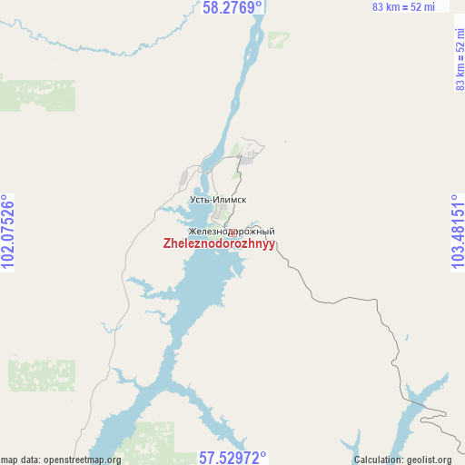
Zheleznodorozhnyy GPS coordinates[2]
57° 54' 18.9" North, 102° 46' 42.168" East
| Map corner | latitude | longitude |
|---|---|---|
| Upper-left | 58.2769°, | 102.07526° |
| Center: | 57.90525°, | 102.77838° |
| Lower-right: | 57.52972°, | 103.48151° |
| Map W x H: | 83.1×83.1 km | = 51.6×51.6mi |
| max Lat: | 73.50819° ⇑17.8% North |
| Zheleznodorozhnyy: | 57.90525° |
| min Lat: | ⇓82.2% South 41.28413° |
| min Long | Zheleznodorozhn | max Long |
| -179.12198° | 102.77838° | 179.35046° |
| W 88.8%⇐ | ⇒11.2% E |
Elevation
Elevation of Zheleznodorozhnyy is 348 m = 1142 ft, and this is 145.4 m = 477 ft above average elevation for this country.
| Max E: |
2518 m = 8261 ft | 13.9% |
| Zheleznodorozhnyy | 348 m 1142 ft | |
| Avg. | 202.6 m = 665 ft | |
Min E: |
-28 m = -92 ft | 86.1% |
See also: Russia elevation on elevation.city.
Geographical zone
Zheleznodorozhnyy is located in North temperate zone (between Tropic of Cancer and the Arctic Circle). Distance of this North polar circle is 962.7 km =598.2 mi to North.| Distance of | km | miles | from Zheleznodorozhnyy |
|---|---|---|---|
| North Pole | 3568.6 | 2217.4 | to North |
| Arctic Circle | 962.7 | 598.2 | to North |
| Tropic Cancer | 3832.5 | 2381.4 | to South |
| Equator | 6438.5 | 4000.7 | to South |


Nearby cities:
15 places around Zheleznodorozhnyy: (largest is in red/bold)
• Bereznyaki
118 km =73.3 mi,  155°
155°
• Bratsk
209.3 km =130.1 mi,  199°
199°
• Khrebtovaya
160.2 km =99.5 mi,  146°
146°
• Kodinsk
224.8 km =139.7 mi,  290°
290°
• Novaya Igirma
109.3 km =67.9 mi,  141°
141°
• Rudnogorsk
91.9 km =57.1 mi, 140°
• Shestakovo
172.6 km =107.2 mi, 155°
• Ust’-Ilimsk
12.6 km =7.8 mi,  327°
327°
• Ust’-Kut
217.7 km =135.3 mi,  124°
124°
• Vanavara
272.9 km =169.6 mi,  354°
354°
• Vidim
167.6 km =104.1 mi,  173°
173°
• Vikhorevka
220.7 km =137.1 mi,  206°
206°
• Yantal’
189.4 km =117.7 mi,  128°
128°
• Zheleznogorsk-Ilimskiy
168.4 km =104.6 mi, 151°
• Zvëzdnyy
256.6 km =159.4 mi, 120°
Sources, notices
• [Note1] Compared only with cities in Russia existing in our database
• [Src1] Map data: © OpenStreetMap contributors (CC-BY-SA)
• [Src2] Other city data from geonames.org with taken over terms of usage.
• [Src3] Geographical zone / Annual Mean Temperature by Robert A. Rohde @ Wikipedia
