Ust’-Kut geodata
Ust’-Kut (Irkutsk Oblast) is a populated place; located in Russia in Asia/Irkutsk (GMT+8) time zone. With population of 48,202 people, there are 441 cities with bigger population in this country. Compared to other cities in Russia, 75.3% of cities are located further ↓South; 89.9% of cities are located further ←West and 84.4% of cities have lower elevation than Ust’-Kut. Note1


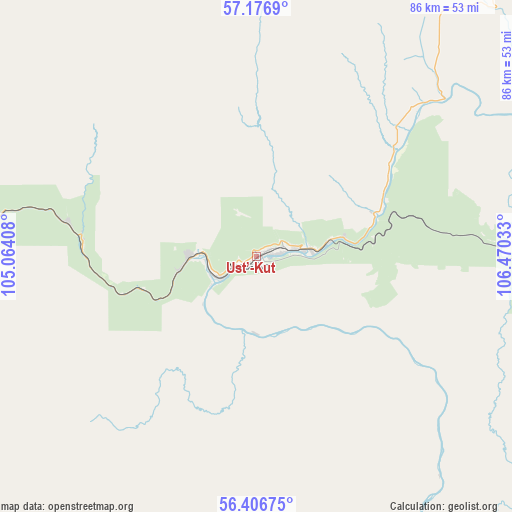
Ust’-Kut GPS coordinates[2]
56° 47' 37.68" North, 105° 46' 1.92" East
| Map corner | latitude | longitude |
|---|---|---|
| Upper-left | 57.1769°, | 105.06408° |
| Center: | 56.7938°, | 105.7672° |
| Lower-right: | 56.40675°, | 106.47033° |
| Map W x H: | 85.6×85.6 km | = 53.2×53.2mi |
| max Lat: | 73.50819° ⇑24.7% North |
| Ust’-Kut: | 56.7938° |
| min Lat: | ⇓75.3% South 41.28413° |
| min Long | Ust’-Kut | max Long |
| -179.12198° | 105.7672° | 179.35046° |
| W 89.9%⇐ | ⇒10.1% E |
Elevation
Elevation of Ust’-Kut is 312 m = 1024 ft, and this is 109.4 m = 359 ft above average elevation for this country.
| Max E: |
2518 m = 8261 ft | 15.6% |
| Ust’-Kut | 312 m 1024 ft | |
| Avg. | 202.6 m = 665 ft | |
Min E: |
-28 m = -92 ft | 84.4% |
See also: Ust’-Kut elevation on elevation.city.
Geographical zone
Ust’-Kut is located in North temperate zone (between Tropic of Cancer and the Arctic Circle). Distance of this North polar circle is 1086.3 km =675 mi to North.| Distance of | km | miles | from Ust’-Kut |
|---|---|---|---|
| North Pole | 3692.2 | 2294.2 | to North |
| Arctic Circle | 1086.3 | 675 | to North |
| Tropic Cancer | 3709 | 2304.7 | to South |
| Equator | 6314.9 | 3923.9 | to South |


Nearby cities:
15 places around Ust’-Kut: (largest is in red/bold)
• Alekseyevskaya
196.9 km =122.3 mi,  53°
53°
• Bereznyaki
133.6 km =83 mi,  276°
276°
• Kazachinskoye
125.3 km =77.9 mi,  117°
117°
• Khrebtovaya
93.1 km =57.8 mi,  263°
263°
• Kirensk
178.9 km =111.2 mi, 51°
• Magistral’nyy
123.9 km =77 mi, 123°
• Markovo
99 km =61.5 mi, 53°
• Novaya Igirma
118.7 km =73.8 mi,  288°
288°
• Rudnogorsk
132.7 km =82.5 mi, 293°
• Shestakovo
115.5 km =71.8 mi,  253°
253°
• Vidim
168.1 km =104.5 mi, 255°
• Yantal’
31.8 km =19.8 mi, 280°
• Zheleznodorozhnyy
217.7 km =135.3 mi,  304°
304°
• Zheleznogorsk-Ilimskiy
103.3 km =64.2 mi, 256°
• Zvëzdnyy
43.7 km =27.2 mi,  96°
96°
Sources, notices
• [Note1] Compared only with cities in Russia existing in our database
• [Src1] Map data: © OpenStreetMap contributors (CC-BY-SA)
• [Src2] Other city data from geonames.org with taken over terms of usage.
• [Src3] Geographical zone / Annual Mean Temperature by Robert A. Rohde @ Wikipedia
