Vysokogornyy geodata
Vysokogornyy (Khabarovsk) is a populated place; located in Russia in Asia/Vladivostok (GMT+10) time zone. With population of 3,926 people, there are 3155 cities with bigger population in this country. Compared to other cities in Russia, 77.8% of cities are located further ↑North; 97.7% of cities are located further ←West and 90% of cities have lower elevation than Vysokogornyy. Note1


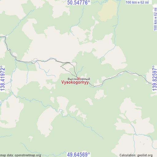
Vysokogornyy GPS coordinates[2]
50° 5' 55.86" North, 139° 7' 22.224" East
| Map corner | latitude | longitude |
|---|---|---|
| Upper-left | 50.54776°, | 138.41972° |
| Center: | 50.09885°, | 139.12284° |
| Lower-right: | 49.64569°, | 139.82597° |
| Map W x H: | 100.3×100.3 km | = 62.3×62.3mi |
| max Lat: | 73.50819° ⇑77.8% North |
| Vysokogornyy: | 50.09885° |
| min Lat: | ⇓22.2% South 41.28413° |
| min Long | Vysokogornyy | max Long |
| -179.12198° | 139.12284° | 179.35046° |
| W 97.7%⇐ | ⇒2.3% E |
Elevation
Elevation of Vysokogornyy is 451 m = 1480 ft, and this is 248.4 m = 815 ft above average elevation for this country.
| Max E: |
2518 m = 8261 ft | 10% |
| Vysokogornyy | 451 m 1480 ft | |
| Avg. | 202.6 m = 665 ft | |
Min E: |
-28 m = -92 ft | 90% |
See also: Russia elevation on elevation.city.
Geographical zone
Vysokogornyy is located in North temperate zone (between Tropic of Cancer and the Arctic Circle). Distance of this North polar circle is 1830.7 km =1137.5 mi to North.| Distance of | km | miles | from Vysokogornyy |
|---|---|---|---|
| North Pole | 4436.6 | 2756.8 | to North |
| Arctic Circle | 1830.7 | 1137.5 | to North |
| Tropic Cancer | 2964.6 | 1842.1 | to South |
| Equator | 5570.5 | 3461.3 | to South |


Nearby cities:
15 places around Vysokogornyy: (largest is in red/bold)
• Amursk
160.4 km =99.7 mi,  275°
275°
• De-Kastri
191.9 km =119.2 mi,  37°
37°
• Gatka
152.4 km =94.7 mi,  151°
151°
• Gurskoye
77.2 km =48 mi,  287°
287°
• Khurba
162.9 km =101.2 mi, 282°
• Komsomolsk-on-Amur
158.2 km =98.3 mi, 288°
• Lososina
149.7 km =93 mi,  144°
144°
• Mayskiy
145.3 km =90.3 mi, 147°
• Selikhino
119.1 km =74 mi, 284°
• Solnechnyy
157.8 km =98.1 mi, 289°
• Solnechnyy
189.2 km =117.6 mi, 291°
• Sovetskaya Gavan’
150.9 km =93.8 mi, 146°
• Tsimmermanovka
138.4 km =86 mi,  3°
3°
• Vanino
137.9 km =85.7 mi, 143°
• Zavety Il’icha
144.1 km =89.5 mi, 144°
Sources, notices
• [Note1] Compared only with cities in Russia existing in our database
• [Src1] Map data: © OpenStreetMap contributors (CC-BY-SA)
• [Src2] Other city data from geonames.org with taken over terms of usage.
• [Src3] Geographical zone / Annual Mean Temperature by Robert A. Rohde @ Wikipedia
