De-Kastri geodata
De-Kastri (Khabarovsk) is a populated place; located in Russia in Asia/Vladivostok (GMT+10) time zone. With population of 3,615 people, there are 3325 cities with bigger population in this country. Compared to other cities in Russia, 72.7% of cities are located further ↑North; 97.9% of cities are located further ←West and 85.1% of cities have higher elevation than De-Kastri. Note1


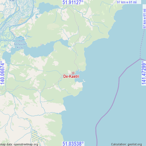
De-Kastri GPS coordinates[2]
51° 28' 31.548" North, 140° 46' 11.496" East
| Map corner | latitude | longitude |
|---|---|---|
| Upper-left | 51.91127°, | 140.06674° |
| Center: | 51.47543°, | 140.76986° |
| Lower-right: | 51.03538°, | 141.47299° |
| Map W x H: | 97.4×97.4 km | = 60.5×60.5mi |
| max Lat: | 73.50819° ⇑72.7% North |
| De-Kastri: | 51.47543° |
| min Lat: | ⇓27.3% South 41.28413° |
| min Long | De-Kastri | max Long |
| -179.12198° | 140.76986° | 179.35046° |
| W 97.9%⇐ | ⇒2.1% E |
Elevation
Elevation of De-Kastri is 47 m = 154 ft, and this is 155.6 m = 510 ft below average elevation for this country.
| Max E: |
2518 m = 8261 ft | 85.1% |
| Avg. | 202.6 m = 665 ft | |
| De-Kastri | 47 m = 154 ft | |
Min E: |
-28 m = -92 ft | 14.9% |
See also: Russia elevation on elevation.city.
Geographical zone
De-Kastri is located in North temperate zone (between Tropic of Cancer and the Arctic Circle). Distance of this North polar circle is 1677.6 km =1042.4 mi to North.| Distance of | km | miles | from De-Kastri |
|---|---|---|---|
| North Pole | 4283.5 | 2661.6 | to North |
| Arctic Circle | 1677.6 | 1042.4 | to North |
| Tropic Cancer | 3117.6 | 1937.2 | to South |
| Equator | 5723.5 | 3556.4 | to South |


Nearby cities:
15 places around De-Kastri: (largest is in red/bold)
• Aleksandrovsk-Sakhalinskiy
116.3 km =72.3 mi,  123°
123°
• Bogorodskoye
102.5 km =63.7 mi,  347°
347°
• Boshnyakovo
226.2 km =140.6 mi,  154°
154°
• Gurskoye
228 km =141.7 mi,  235°
235°
• Katangli
171.6 km =106.6 mi,  80°
80°
• Lazarev
97.5 km =60.6 mi,  31°
31°
• Mago
202.2 km =125.6 mi, 348°
• Mgachi
114.6 km =71.2 mi,  114°
114°
• Nikolayevsk-on-Amure
185.8 km =115.5 mi,  359°
359°
• Nogliki
167.4 km =104 mi, 77°
• Smirnykh
241.3 km =149.9 mi,  142°
142°
• Tsimmermanovka
106.4 km =66.1 mi,  261°
261°
• Tymovskoye
149.4 km =92.8 mi, 117°
• Val
184.3 km =114.5 mi,  58°
58°
• Vysokogornyy
191.9 km =119.2 mi,  217°
217°
Sources, notices
• [Note1] Compared only with cities in Russia existing in our database
• [Src1] Map data: © OpenStreetMap contributors (CC-BY-SA)
• [Src2] Other city data from geonames.org with taken over terms of usage.
• [Src3] Geographical zone / Annual Mean Temperature by Robert A. Rohde @ Wikipedia
