Gurskoye geodata
Gurskoye (Khabarovsk) is a populated place; located in Russia in Asia/Vladivostok (GMT+10) time zone. With population of 822 people, there are 4742 cities with bigger population in this country. Compared to other cities in Russia, 77.2% of cities are located further ↑North; 97.6% of cities are located further ←West and 54.9% of cities have lower elevation than Gurskoye. Note1


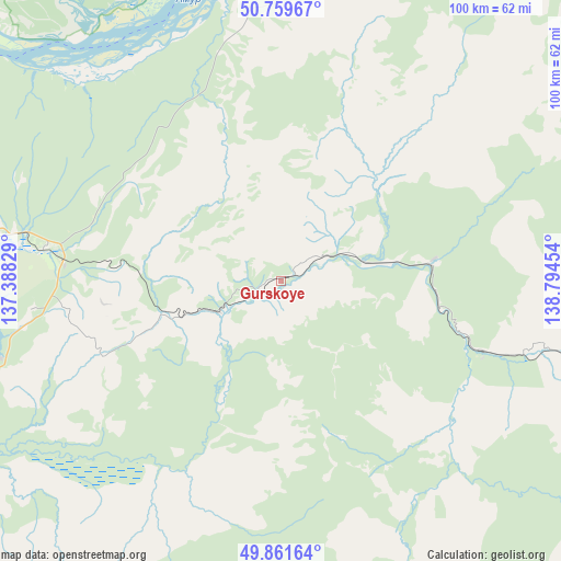
Gurskoye GPS coordinates[2]
50° 18' 46.008" North, 138° 5' 29.076" East
| Map corner | latitude | longitude |
|---|---|---|
| Upper-left | 50.75967°, | 137.38829° |
| Center: | 50.31278°, | 138.09141° |
| Lower-right: | 49.86164°, | 138.79454° |
| Map W x H: | 99.9×99.8 km | = 62.1×62mi |
| max Lat: | 73.50819° ⇑77.2% North |
| Gurskoye: | 50.31278° |
| min Lat: | ⇓22.8% South 41.28413° |
| min Long | Gurskoye | max Long |
| -179.12198° | 138.09141° | 179.35046° |
| W 97.6%⇐ | ⇒2.4% E |
Elevation
Elevation of Gurskoye is 156 m = 512 ft, and this is 46.6 m = 153 ft below average elevation for this country.
| Max E: |
2518 m = 8261 ft | 45.1% |
| Avg. | 202.6 m = 665 ft | |
| Gurskoye | 156 m = 512 ft | |
Min E: |
-28 m = -92 ft | 54.9% |
See also: Russia elevation on elevation.city.
Geographical zone
Gurskoye is located in North temperate zone (between Tropic of Cancer and the Arctic Circle). Distance of this North polar circle is 1806.9 km =1122.8 mi to North.| Distance of | km | miles | from Gurskoye |
|---|---|---|---|
| North Pole | 4412.8 | 2742 | to North |
| Arctic Circle | 1806.9 | 1122.8 | to North |
| Tropic Cancer | 2988.3 | 1856.8 | to South |
| Equator | 5594.3 | 3476.1 | to South |


Nearby cities:
15 places around Gurskoye: (largest is in red/bold)
• Amursk
86.4 km =53.7 mi,  264°
264°
• Gatka
215.6 km =134 mi,  136°
136°
• Gorin
140.7 km =87.4 mi,  314°
314°
• Gornyy
126.4 km =78.5 mi,  293°
293°
• Khurba
86.4 km =53.7 mi,  276°
276°
• Komsomolsk-on-Amur
81 km =50.3 mi, 289°
• Mayskiy
211.2 km =131.2 mi,  133°
133°
• Selikhino
42.3 km =26.3 mi, 278°
• Sinda
197.8 km =122.9 mi,  220°
220°
• Solnechnyy
80.7 km =50.1 mi, 291°
• Solnechnyy
112.4 km =69.8 mi, 293°
• Tsimmermanovka
140.3 km =87.2 mi,  35°
35°
• Vanino
205.9 km =127.9 mi, 130°
• Vysokogornyy
77.2 km =48 mi,  107°
107°
• Zavety Il’icha
211.4 km =131.4 mi, 132°
Sources, notices
• [Note1] Compared only with cities in Russia existing in our database
• [Src1] Map data: © OpenStreetMap contributors (CC-BY-SA)
• [Src2] Other city data from geonames.org with taken over terms of usage.
• [Src3] Geographical zone / Annual Mean Temperature by Robert A. Rohde @ Wikipedia
