Ust’-Uda geodata
Ust’-Uda (Irkutsk Oblast) is a populated place; located in Russia in Asia/Irkutsk (GMT+8) time zone. With population of 5,169 people, there are 2570 cities with bigger population in this country. Compared to other cities in Russia, 53.7% of cities are located further ↑North; 88.8% of cities are located further ←West and 89.2% of cities have lower elevation than Ust’-Uda. Note1


Ust’-Uda GPS coordinates[2]
54° 10' 27.12" North, 103° 1' 49.44" East
| Map corner | latitude | longitude |
|---|---|---|
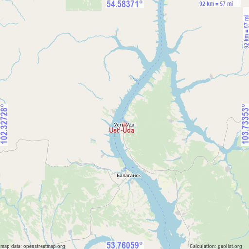
| Upper-left | 54.58371°, | 102.32728° |
| Center: | 54.1742°, | 103.0304° |
| Lower-right: | 53.76059°, | 103.73353° |
| Map W x H: | 91.5×91.5 km | = 56.9×56.9mi |
| max Lat: | 73.50819° ⇑53.7% North |
| Ust’-Uda: | 54.1742° |
| min Lat: | ⇓46.3% South 41.28413° |
| min Long | Ust’-Uda | max Long |
| -179.12198° | 103.0304° | 179.35046° |
| W 88.8%⇐ | ⇒11.2% E |
Elevation
Elevation of Ust’-Uda is 433 m = 1421 ft, and this is 230.4 m = 756 ft above average elevation for this country.
| Max E: |
2518 m = 8261 ft | 10.8% |
| Ust’-Uda | 433 m 1421 ft | |
| Avg. | 202.6 m = 665 ft | |
Min E: |
-28 m = -92 ft | 89.2% |
See also: Russia elevation on elevation.city.
Geographical zone
Ust’-Uda is located in North temperate zone (between Tropic of Cancer and the Arctic Circle). Distance of this North polar circle is 1377.6 km =856 mi to North.| Distance of | km | miles | from Ust’-Uda |
|---|---|---|---|
| North Pole | 3983.5 | 2475.2 | to North |
| Arctic Circle | 1377.6 | 856 | to North |
| Tropic Cancer | 3417.7 | 2123.7 | to South |
| Equator | 6023.6 | 3742.9 | to South |


Nearby cities:
15 places around Ust’-Uda: (largest is in red/bold)
• Balagansk
18.8 km =11.7 mi,  175°
175°
• Bokhan
123.6 km =76.8 mi,  156°
156°
• Cheremkhovo
113.2 km =70.3 mi, 178°
• Kimil’tey
68.5 km =42.6 mi,  266°
266°
• Kutulik
93 km =57.8 mi,  190°
190°
• Kuytun
100.6 km =62.5 mi,  280°
280°
• Novonukutskiy
56.7 km =35.2 mi,  201°
201°
• Osa
103.7 km =64.4 mi,  147°
147°
• Sayansk
56.8 km =35.3 mi,  262°
262°
• Sheragul
141.2 km =87.7 mi, 283°
• Svirsk
122.6 km =76.2 mi,  170°
170°
• Tulyushka
124.7 km =77.5 mi, 284°
• Tyret’ Pervaya
73.2 km =45.5 mi,  220°
220°
• Zalari
76.6 km =47.6 mi,  206°
206°
• Zima
70.3 km =43.7 mi,  246°
246°
Sources, notices
• [Note1] Compared only with cities in Russia existing in our database
• [Src1] Map data: © OpenStreetMap contributors (CC-BY-SA)
• [Src2] Other city data from geonames.org with taken over terms of usage.
• [Src3] Geographical zone / Annual Mean Temperature by Robert A. Rohde @ Wikipedia
