Balagansk geodata
Balagansk (Irkutsk Oblast) is a populated place; located in Russia in Asia/Irkutsk (GMT+8) time zone. With population of 4,195 people, there are 3001 cities with bigger population in this country. Compared to other cities in Russia, 55.2% of cities are located further ↑North; 88.8% of cities are located further ←West and 89.2% of cities have lower elevation than Balagansk. Note1


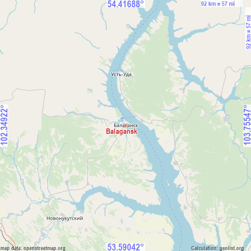
Balagansk GPS coordinates[2]
54° 0' 20.52" North, 103° 3' 8.424" East
| Map corner | latitude | longitude |
|---|---|---|
| Upper-left | 54.41688°, | 102.34922° |
| Center: | 54.0057°, | 103.05234° |
| Lower-right: | 53.59042°, | 103.75547° |
| Map W x H: | 91.9×91.9 km | = 57.1×57.1mi |
| max Lat: | 73.50819° ⇑55.2% North |
| Balagansk: | 54.0057° |
| min Lat: | ⇓44.8% South 41.28413° |
| min Long | Balagansk | max Long |
| -179.12198° | 103.05234° | 179.35046° |
| W 88.8%⇐ | ⇒11.2% E |
Elevation
Elevation of Balagansk is 433 m = 1421 ft, and this is 230.4 m = 756 ft above average elevation for this country.
| Max E: |
2518 m = 8261 ft | 10.8% |
| Balagansk | 433 m 1421 ft | |
| Avg. | 202.6 m = 665 ft | |
Min E: |
-28 m = -92 ft | 89.2% |
See also: Russia elevation on elevation.city.
Geographical zone
Balagansk is located in North temperate zone (between Tropic of Cancer and the Arctic Circle). Distance of this North polar circle is 1396.3 km =867.6 mi to North.| Distance of | km | miles | from Balagansk |
|---|---|---|---|
| North Pole | 4002.2 | 2486.9 | to North |
| Arctic Circle | 1396.3 | 867.6 | to North |
| Tropic Cancer | 3399 | 2112 | to South |
| Equator | 6004.9 | 3731.3 | to South |


Nearby cities:
15 places around Balagansk: (largest is in red/bold)
• Bokhan
106 km =65.9 mi,  153°
153°
• Cheremkhovo
94.5 km =58.7 mi,  179°
179°
• Kimil’tey
71.3 km =44.3 mi,  281°
281°
• Kutulik
74.9 km =46.5 mi,  193°
193°
• Kuytun
107.2 km =66.6 mi,  290°
290°
• Mishelevka
127.9 km =79.5 mi, 176°
• Novonukutskiy
40.7 km =25.3 mi,  213°
213°
• Osa
87.6 km =54.4 mi,  141°
141°
• Sayansk
59 km =36.7 mi, 281°
• Sredniy
127.6 km =79.3 mi,  166°
166°
• Svirsk
103.9 km =64.6 mi, 169°
• Tyret’ Pervaya
61.3 km =38.1 mi,  232°
232°
• Ust’-Uda
18.8 km =11.7 mi,  355°
355°
• Zalari
61.3 km =38.1 mi,  215°
215°
• Zima
66.6 km =41.4 mi,  261°
261°
Sources, notices
• [Note1] Compared only with cities in Russia existing in our database
• [Src1] Map data: © OpenStreetMap contributors (CC-BY-SA)
• [Src2] Other city data from geonames.org with taken over terms of usage.
• [Src3] Geographical zone / Annual Mean Temperature by Robert A. Rohde @ Wikipedia
