Nizhneangarsk geodata
Nizhneangarsk (Buryatiya Republic) is a populated place; located in Russia in Asia/Irkutsk (GMT+8) time zone. With population of 5,493 people, there are 2442 cities with bigger population in this country. Compared to other cities in Russia, 63.4% of cities are located further ↓South; 91.1% of cities are located further ←West and 91% of cities have lower elevation than Nizhneangarsk. Note1


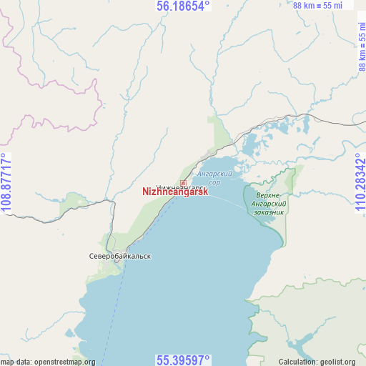
Nizhneangarsk GPS coordinates[2]
55° 47' 35.736" North, 109° 34' 49.044" East
| Map corner | latitude | longitude |
|---|---|---|
| Upper-left | 56.18654°, | 108.87717° |
| Center: | 55.79326°, | 109.58029° |
| Lower-right: | 55.39597°, | 110.28342° |
| Map W x H: | 87.9×87.9 km | = 54.6×54.6mi |
| max Lat: | 73.50819° ⇑36.6% North |
| Nizhneangarsk: | 55.79326° |
| min Lat: | ⇓63.4% South 41.28413° |
| min Long | Nizhneangarsk | max Long |
| -179.12198° | 109.58029° | 179.35046° |
| W 91.1%⇐ | ⇒8.9% E |
Elevation
Elevation of Nizhneangarsk is 477 m = 1565 ft, and this is 274.4 m = 900 ft above average elevation for this country.
| Max E: |
2518 m = 8261 ft | 9% |
| Nizhneangarsk | 477 m 1565 ft | |
| Avg. | 202.6 m = 665 ft | |
Min E: |
-28 m = -92 ft | 91% |
See also: Russia elevation on elevation.city.
Geographical zone
Nizhneangarsk is located in North temperate zone (between Tropic of Cancer and the Arctic Circle). Distance of this North polar circle is 1197.5 km =744.1 mi to North.| Distance of | km | miles | from Nizhneangarsk |
|---|---|---|---|
| North Pole | 3803.4 | 2363.3 | to North |
| Arctic Circle | 1197.5 | 744.1 | to North |
| Tropic Cancer | 3597.7 | 2235.5 | to South |
| Equator | 6203.6 | 3854.7 | to South |


Nearby cities:
15 places around Nizhneangarsk: (largest is in red/bold)
• Alekseyevskaya
239.7 km =148.9 mi,  342°
342°
• Barguzin
241.8 km =150.2 mi,  179°
179°
• Gorno-Chuyskiy
243.6 km =151.4 mi,  32°
32°
• Kazachinskoye
135.3 km =84.1 mi,  293°
293°
• Kichera
36.3 km =22.6 mi,  63°
63°
• Kirensk
238.8 km =148.4 mi, 338°
• Kurumkan
170.1 km =105.7 mi,  164°
164°
• Magistral’nyy
139.5 km =86.7 mi, 287°
• Markovo
228.4 km =141.9 mi,  318°
318°
• Novyy Uoyan
138.3 km =85.9 mi,  72°
72°
• Severobaykal’sk
23.7 km =14.7 mi,  222°
222°
• Severomuysk
242.5 km =150.7 mi,  80°
80°
• Ust’-Kut
260.2 km =161.7 mi,  295°
295°
• Yanchukan
206.3 km =128.2 mi, 75°
• Zvëzdnyy
218.9 km =136 mi, 299°
Sources, notices
• [Note1] Compared only with cities in Russia existing in our database
• [Src1] Map data: © OpenStreetMap contributors (CC-BY-SA)
• [Src2] Other city data from geonames.org with taken over terms of usage.
• [Src3] Geographical zone / Annual Mean Temperature by Robert A. Rohde @ Wikipedia
