Mogocha geodata
Mogocha (Transbaikal Territory) is a populated place; located in Russia in Asia/Chita (GMT+9) time zone. With population of 12,647 people, there are 1226 cities with bigger population in this country. Compared to other cities in Russia, 57.2% of cities are located further ↑North; 93% of cities are located further ←West and 95.2% of cities have lower elevation than Mogocha. Note1


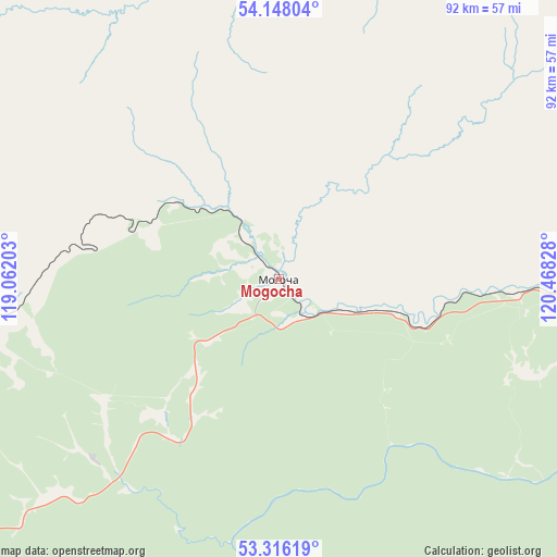
Mogocha GPS coordinates[2]
53° 44' 3.012" North, 119° 45' 54.54" East
| Map corner | latitude | longitude |
|---|---|---|
| Upper-left | 54.14804°, | 119.06203° |
| Center: | 53.73417°, | 119.76515° |
| Lower-right: | 53.31619°, | 120.46828° |
| Map W x H: | 92.5×92.5 km | = 57.5×57.5mi |
| max Lat: | 73.50819° ⇑57.2% North |
| Mogocha: | 53.73417° |
| min Lat: | ⇓42.8% South 41.28413° |
| min Long | Mogocha | max Long |
| -179.12198° | 119.76515° | 179.35046° |
| W 93%⇐ | ⇒7% E |
Elevation
Elevation of Mogocha is 650 m = 2133 ft, and this is 447.4 m = 1468 ft above average elevation for this country.
| Max E: |
2518 m = 8261 ft | 4.8% |
| Mogocha | 650 m 2133 ft | |
| Avg. | 202.6 m = 665 ft | |
Min E: |
-28 m = -92 ft | 95.2% |
See also: Russia elevation on elevation.city.
Geographical zone
Mogocha is located in North temperate zone (between Tropic of Cancer and the Arctic Circle). Distance of this North polar circle is 1426.5 km =886.4 mi to North.| Distance of | km | miles | from Mogocha |
|---|---|---|---|
| North Pole | 4032.4 | 2505.6 | to North |
| Arctic Circle | 1426.5 | 886.4 | to North |
| Tropic Cancer | 3368.8 | 2093.3 | to South |
| Equator | 5974.7 | 3712.5 | to South |


Nearby cities:
15 places around Mogocha: (largest is in red/bold)
• Amazar
74.5 km =46.3 mi,  79°
79°
• Bukachacha
206.6 km =128.4 mi,  246°
246°
• Chernyshevsk
227.5 km =141.4 mi,  233°
233°
• Davenda
35.6 km =22.1 mi,  235°
235°
• Gazimurskiy Zavod
260.7 km =162 mi,  201°
201°
• Klyuchevskiy
30.4 km =18.9 mi,  222°
222°
• Kokuy
225.3 km =140 mi, 221°
• Nerchinskiy Zavod
269.9 km =167.7 mi,  182°
182°
• Sretensk
215.1 km =133.7 mi, 219°
• Takhtamygda
255 km =158.4 mi, 80°
• Tupik
77.6 km =48.2 mi,  8°
8°
• Urusha
207.5 km =128.9 mi, 80°
• Ust’-Karsk
131.5 km =81.7 mi,  209°
209°
• Yerofey Pavlovich
146.1 km =90.8 mi, 79°
• Zhireken
192 km =119.3 mi, 238°
In other languages:
- In France: Mogotcha
- In German: Mogotscha
- In Italian: Mogoča
- In Russian: Могоча
- In Chinese: 莫戈恰
Sources, notices
• [Note1] Compared only with cities in Russia existing in our database
• [Src1] Map data: © OpenStreetMap contributors (CC-BY-SA)
• [Src2] Other city data from geonames.org with taken over terms of usage.
• [Src3] Geographical zone / Annual Mean Temperature by Robert A. Rohde @ Wikipedia
