Sretensk geodata
Sretensk (Transbaikal Territory) is a populated place; located in Russia in Asia/Chita (GMT+9) time zone. With population of 7,698 people, there are 1870 cities with bigger population in this country. Compared to other cities in Russia, 67.7% of cities are located further ↑North; 92.7% of cities are located further ←West and 89.8% of cities have lower elevation than Sretensk. Note1


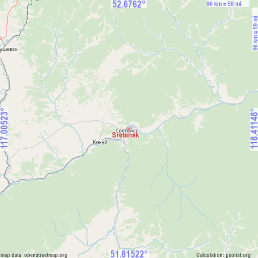
Sretensk GPS coordinates[2]
52° 14' 52.08" North, 117° 42' 30.06" East
| Map corner | latitude | longitude |
|---|---|---|
| Upper-left | 52.6762°, | 117.00523° |
| Center: | 52.2478°, | 117.70835° |
| Lower-right: | 51.81522°, | 118.41148° |
| Map W x H: | 95.7×95.7 km | = 59.5×59.5mi |
| max Lat: | 73.50819° ⇑67.7% North |
| Sretensk: | 52.2478° |
| min Lat: | ⇓32.3% South 41.28413° |
| min Long | Sretensk | max Long |
| -179.12198° | 117.70835° | 179.35046° |
| W 92.7%⇐ | ⇒7.3% E |
Elevation
Elevation of Sretensk is 448 m = 1470 ft, and this is 245.4 m = 805 ft above average elevation for this country.
| Max E: |
2518 m = 8261 ft | 10.2% |
| Sretensk | 448 m 1470 ft | |
| Avg. | 202.6 m = 665 ft | |
Min E: |
-28 m = -92 ft | 89.8% |
See also: Russia elevation on elevation.city.
Geographical zone
Sretensk is located in North temperate zone (between Tropic of Cancer and the Arctic Circle). Distance of this North polar circle is 1591.8 km =989.1 mi to North.| Distance of | km | miles | from Sretensk |
|---|---|---|---|
| North Pole | 4197.7 | 2608.3 | to North |
| Arctic Circle | 1591.8 | 989.1 | to North |
| Tropic Cancer | 3203.5 | 1990.6 | to South |
| Equator | 5809.4 | 3609.8 | to South |


Nearby cities:
15 places around Sretensk: (largest is in red/bold)
• Aleksandrovskiy Zavod
147.9 km =91.9 mi,  173°
173°
• Arbagar
105.6 km =65.6 mi,  250°
250°
• Baley
104.5 km =64.9 mi,  224°
224°
• Bukachacha
97.7 km =60.7 mi,  326°
326°
• Chernyshevsk
56 km =34.8 mi,  303°
303°
• Gazimurskiy Zavod
88.7 km =55.1 mi,  150°
150°
• Kholbon
107.6 km =66.9 mi, 247°
• Kokuy
11.5 km =7.1 mi, 246°
• Nerchinsk
82.2 km =51.1 mi, 249°
• Priiskovyy
81.3 km =50.5 mi,  244°
244°
• Shelopugino
66.9 km =41.6 mi,  188°
188°
• Shilka
122.8 km =76.3 mi, 248°
• Ust’-Karsk
89.6 km =55.7 mi,  55°
55°
• Vershino-Shakhtaminskiy
106.1 km =65.9 mi, 173°
• Zhireken
69.8 km =43.4 mi,  337°
337°
Sources, notices
• [Note1] Compared only with cities in Russia existing in our database
• [Src1] Map data: © OpenStreetMap contributors (CC-BY-SA)
• [Src2] Other city data from geonames.org with taken over terms of usage.
• [Src3] Geographical zone / Annual Mean Temperature by Robert A. Rohde @ Wikipedia
